Tropical
Storm and Hurricane Noel Page
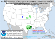
Current Tropical Weather Discussion
NHC Advisory
Mailing Lists North
Atlantic - Water Vapor Loop North
Atlantic - Infrared Channel 2 Loop
Index
|
|
Very large and dangerous Post-Tropical Storm
Noel forecast to move into the Canadian Maritimes this weekend.
Add This Page To Favorites 
|
November 4, 2007 --
Post-Tropical Storm Noel Final Information Statement Issued
By The Canadian Hurricane Centre Of Environment Canada At 6.00 Pm AST Sunday 04
November 2007
This will be the last bulletin issued on post-Tropical Storm
Noel.
Post-tropical storm noel is now completely extratropical and
as a result Canadian Hurricane Centre bulletins are no longer necessary. Further information on the weather
associated with this storm can be found in regular bulletins issued by the Quebec
and Atlantic Storm Prediction Centres and the Newfoundland and Labrador Weather
Office
Synoptic summary of the storm... Late on Saturday October 27
a persistent low pressure center about 200 km south southeast of Haiti became
tropical depression sixteen. By Sunday
afternoon while still well south of Haiti the tropical depression became
tropical storm noel.. The 14th named storm of the Atlantic hurricane season.
Over the following days noel tracked erratically through Haiti Cuba and the Bahamas...
Never reaching much more than 90 km/h in sustained winds. However torrential
rains of more than 500 mm in some Caribbean countries claimed more than 100
lives in flooding and mudslides. Once noel cleared the Bahamas it intensified
quickly to a category one hurricane late Thursday November 1. Subsequently
hurricane noel continued moving northeast with maximum sustained winds of near
140 km/h. Almost immediately after becoming a hurricane noel began
transitioning to a post-tropical storm. During this transition it became a very
large and powerful post-tropical storm. The Storm Centre reached the southwest
coast of Nova Scotia in the early
morning hours of Sunday November 4 still carrying maximum sustained winds of 140 km/h. By Sunday afternoon the
storm was over Labrador and fully extratropical in nature.
Weather in eastern Canada... Gales moved into southwestern
maritime waters near dawn Saturday November 3 while the Storm Centre was still
1100 km southwest of Nova Scotia. Strong winds and rain moved into southwestern
Maritimes Saturday afternoon and pushed steadily northeastward through eastern
Canada Saturday night and Sunday. Snow developed with the system in
northwestern New Brunswick southeastern Quebec and Labrador.
Impacts... The worst hit province was Nova Scotia with
widespread power outages.. Localized flooding.. Uprooted trees.. Road
washouts.. And some infrastructure damage... Especially along the Atlantic
Coast.
Summary Wind And Rain Data From New Brunswick Total Rainfall Max. Wind Gust
Amounts (Mm) (Km/H)
Saint John 71.2 82
Point Lepreau 81.2 82
Grand Manan 59.0 82
St Stephen 72.4 63
Fredericton 56.7 83
Gagetown 66.0 72
Mechanic Settlement 67.0 85
Fundy Park 59.8 N/A
Moncton 72.2 96
Bouctouche 55.0 72
Kouchibouguac 86.1 N/A
Miramichi 68.0 67
Bas Caraquet 95.6 72
Miscou Island 59.6 87
Bathurst 89.8 69
Charlo 62.0 56
Edmunston 52.7 N/A
St Léonard N/A 57
Meadowbrook 112.3
Summary Wind And Rain Data From Pei Total Rainfall Max. Wind Gust Amounts (Mm)
(Km/H)
Charlottetown 28.2 96
Summerside 45.2 93
North Point 54.7 111
St Peter's 35.4 102
East Point 21.7 111
Harrington Harbour 27.9 106
Maple Plains N/A 87
Summary Wind And Rain Data From The Magdalen Islands Total Rainfall Max. Wind
Gust Amounts (Mm) (Km/H)
Grindstone Island 26.6 115
Summary Wind And Rain Data From Nova Scotia ...Total Rainfall Max. Wind Gust
Amounts (Mm) (Km/H)
Yarmouth 50.4 85
Brier Island 37.0 107
Baccaro Point 76.9 126
Western Head 73.8 104
Lunenburg N/A 104
Shearwater 36.7 N/A
Mcnabs Island N/A 135
Halifax Int'l'53.1 113
Kentville 70.5 81
Greenwood (Windy Hill) 51.7
(100)
Kejimkujik 71.6 N/A
Upper Stewiacke 34.5 104
Debert 35.5 102
Parrsboro 60.9 67
Nappan 53.2 91
Caribou Point * 18.7 122
Tracadie 57.8 106
Malay Falls 57.9 N/A
Beaver Island N/A 137
Hart Island N/A 124
Sydney 67.6 102
Ingonish Beach 112.3 94
Grand Etang N/A 146
North
Mountain
N/A
96
St Paul
Island
N/A
128
Additionally An Unofficial Observation From Smelt Brook Just To The East Of
Dingwall In Cape Breton Reported 130 Mm Of Rain.
* Station Ceased Reporting At 6.00 A.M. Ast Sunday Morning.
Summary Wind Data From Newfoundland ...Max. Wind Gust (Km/H)
Burgeo 111
St. Lawrence 94
Winterland 104
Port Aux Basques 113
Sagona 135
St. John's 80
Bonavista 111
Gander 98
Deer Lake 95
Stephenville 95
Wreckhouse 180
Daniel's Harbour 109
Ferolle Point 104
Notable marine data from maritime and Newfoundland waters ... A peak wind of 66
knots or 122 km/h was reported at the West Scotian Slope buoy. The highest
significant wave height of 13.9 metres was reported at the Georges Bank buoy.
The Halifax Wave Rider buoy reported a significant wave height of 10.3 metres.
Summary storm data from affected regions in southeastern
Quebec and Labrador will not be available until some time Monday.
END BOWYER
Dominican Republic: Tropical Storm Noel OCHA Situation Report No. 1
Dominican Republic: Tropical Storm Noel OCHA Situation Report No. 2
|
2007 -- Hurricane --
Tropical Storm Noel
Diary
(return
to top of page)
Current
Weather
Watches
Short Floater - Infrared
Channel 2 Loop


Today's
National
Forecast
Current
Weather
National Weather Warnings


Day
1
Forecast
Precipitation
Day 2 Forecast Precipitation


If
you have any
Questions, Comments or suggestions please send an email to:
Host@disastercenter.com 
DURING
A HURRICANE WATCH
(A Hurricane Watch is issued when there is a threat of hurricane
conditions within 24-36 hours.)
1. Listen to a battery-operated radio or television for hurricane
progress reports.
2. Check emergency supply kit.
3. Fuel car.
4. Bring in outdoor objects such as lawn furniture, toys, and garden
tools and anchor objects that cannot be brought inside.
5. Secure buildings by closing and boarding up windows. Remove outside
antennas.
6. Turn refrigerator and freezer to coldest settings. Open only when
absolutely necessary and close quickly.
7. Store drinking water in clean bathtubs, jugs, bottles, and cooking
utensils.
8. Store valuables and personal papers in a waterproof container on the
highest level of your home. 9. Review evacuation plan.
10. Moor boat securely or move it to a designated safe place. Use rope
or chain to secure boat to trailer. Use tiedowns to anchor trailer to
the ground or house.
Source: floridadisaster.org/
Florida's Division of Emergency
Management
(return
to top of page)
History
of Storms Named Tropical Storm -- In 1995 and 2001 category 1
Hurricane's named Noel formed that did not present any danger to
land.
1995 Tracking
information -- 2001 Tracking
information -- 1995 IR
Satellite 2001 Tropical Cyclone Report -
Hurricane Noel
Year 2007
Hurricane Noel Diary
November 3, 2007 --
Post-Tropical Storm Noel Information Statement Issued By The
Canadian Hurricane Centre of Environment Canada At 3.00 PM AST Sunday 04
November 2007.
... Post-Tropical Noel moving into Labrador..
1. Current position, strength, central pressure and motion
At 2.00 PM AST... Post-tropical storm noel was located near latitude
51.2 n and longitude 62.2 w, about 62 nautical miles or 116 km north of Natashquan
Québec. Maximum sustained winds are estimated at 60 knots... 111 km/h, and
central pressure at 966 mb. Noel is moving north-northeast at 41 knots... 76
km/h.
2. Forecast position, central pressure and strength
DATE TIME
LAT LON MSLP MAX WIND
AST
MB KTS KMH
NOV 04 2.00 PM 51.2N 62.2W 966
60 111 POST-TROPICAL
NOV 04 8.00 PM 55.0N 58.9W 966
55 102 POST-TROPICAL
NOV 05 2.00 AM 57.6N 56.8W 968
55 102 POST-TROPICAL
NOV 05 8.00 AM 59.9N 54.9W 969
55 102 POST-TROPICAL
NOV 05 2.00 PM 62.4N 53.1W 978
45 83 POST-TROPICAL
3. Public weather impacts and warnings summary all rainfall
warning shave ended. Wind warnings are being systematically ended as
post-tropical noel moves northeastward and this trend will continue. Snowfall
warnings in Quebec have ended but heavy snowfall and blowing snow warnings
remain in Labrador.
4. Marine weather impacts and warnings summary storm and
gale warnings remain in maritime and Newfoundland waters in the wake of
post-tropical noel but these should end tonight. Gale warnings will remain in Labrador
waters until the storm system passes well to the north late Monday
5. Technical discussion
A. Analysis an elongated area of low pressure, possibly with
two centers, is evident in the pressure field. It is clear that this system is now
fully extratropical. Gusts in the 60s
in the gulf waters and gusts in the 40s in waters south of Nova Scotia convince
us to maintain at least 60 kts sustained winds with the system at 18z.
B. Prognostic we mostly follow the gem package. Pressure
continues being lower than initialized by the model.
C. Public weather nothing additional.
D. Marine weather hurricane force gusts in some
maritime waters still linger but these should be gone shortly.
November 3, 2007 -- Post-Tropical Storm Noel Information Statement Issued By The
Canadian Hurricane Centre Of Environment Canada At 9.00 Pm ADT Saturday 03 November
2007.
Weather Conditions Deteriorating As Noel Approaches The Maritimes. Preparation Efforts
Should Now Be Completed...
1. Current position, strength, central pressure and motion
At 9.00 PM ADT... Post-tropical storm noel was located near latitude 40.7 n and
longitude 68.5 w, about 220 nautical miles or 400 km south southwest of Yarmouth
Nova Scotia. Maximum sustained winds are estimated at 75 knots...139 km/h...and
central pressure at 968 mb. Noel is moving north-northeast at 31 knots...57
km/h.
2. Forecast position, central pressure and strength
Date Time Lat
Lon Mslp Max Wind
ADT
Mb Kts Kmh
Nov 03 9.00 Pm 40.7n 68.5w 968
75 139 Post-Tropical
Nov 04 2.00 Am 43.5n 66.8w 965
75 139 Post-Tropical
Nov 04 8.00 Am 47.1n 64.8w 962
70 130 Post-Tropical
Nov 04 2.00 Pm 50.7n 62.5w 965
60 111 Post-Tropical
Nov 04 8.00 Pm 53.9n 60.1w 966
60 111 Post-Tropical
Nov 05 2.00 Am 56.9n 58.3w 968
55 102 Post-Tropical
Nov 05 8.00 Am 59.2n 57.2w 969
55 102 Post-Tropical
Nov 05 2.00 Pm 62.0n 56.3w 972
50 93 Post-Tropical
Nov 05 8.00 Pm 64.7n 55.8w 978
50 93 Post-Tropical
The current track has been moved back toward the east of the previous one, based
on a farther-east storm position at forecast time. This track brings the storm
center just west of Nova Scotia, into the Bay of Fundy then across southeastern
New Brunswick and eventually through central Labrador.
Although noel is a post-tropical storm we expect it to be accompanied by
hurricane force winds. The public is advised not to focus on the actual track
of the Storm Centre since the high winds and heavy rains will extend very far
from the track line itself.
3. Public weather impacts and warnings summary
The number of warnings for this storm are too numerous to list but are summarized here with details being
available in bulletins issued by the Quebec
and Atlantic Storm Prediction Centres and the Newfoundland and Labrador weather
office, wind and/or rain warnings are in effect for Québec, New Brunswick, Pei, Nova Scotia, and Newfoundland and Labrador.
Heavy snowfall warnings are in effect for Churchill Falls and northern Labrador.
The strongest winds are expected to be in the Newfoundland Wreckhouse area and
in Les Suetes in the Cape Breton Highlands...100 km/h gusting to 180/160
respectively. 140 km/h wind gusts are forecast
over parts of nova scotia.
Heaviest rainfall forecast is 100 mm in portions of New Brunswick.
Significant wave heights of 10 m have been observed west of the storm and are
likely 12 m east of it. We are warning that these energetic waves will create
dangerous pounding surf conditions along the Atlantic Coast of Nova Scotia tonight
and Sunday morning and we advise people
to exercise extreme caution near these shores. Media reports have alerted us to
a high level of interest in these waves by the public and we advise against anyone
testing these waters or even going near the shore.
Storm surge is unlikely to be a major problem because tides are running lower than
normal. We do not expect total water levels to be much above high astronomical
tide.
Damage/impacts...
Where wind gusts to and above hurricane force (120 km/h) are forecast
Expect tree limbs and branches to break which will likely lead to downed power
lines and power interruptions. Some trees will likely be uprooted. These winds
will cause damage to roofing and cladding material on some homes. Some signage
could also suffer damage with winds gusting this high. Also, with 11-metre
waves expected along the Atlantic Coast of Nova Scotia... And upwards of
8-metres in the northeast Gulf of St. Lawrence on Sunday. Coastal erosion of some
beaches is likely with possible damage to wharves and docks. Rainfall may cause
localized flooding in prone areas, especially where leaf litter clogs storm
drains.
Embedded thundershowers are being reported over parts of Nova Scotia. Winds could be particularly gusty in these
thundershowers.
4. Marine weather impacts and warnings summary
Hurricane force wind warnings are in effect for southwestern maritime waters
and most Gulf of St Lawrence waters. Storm and gale warnings are in effect for
remaining waters of the Maritimes, Newfoundland, and for southern Labrador as
well as for some St.
Lawrence River waters.
5. Technical discussion
a. Analysis
Buoy reports are confirming winds near 70 knots on the western side of the
storm along with 11 m sig wave heights. The storm center has passed east of
buoy 44008 to the southeast of Cape Cod.
Goes imagery provide a good center fix on the position and clearly shows the
energetic nature of the storm with convection still active near storm core.
B. Prognostic
Initial motion is based on current extrapolation and model forecasts.
The track has been bumped back toward the east during the first part of the
forecast period, similar to the track issued last night.
C. Public weather details above.
D. Marine weather
Traditional wind radii table is left out given that the wind distribution
around the storm is much different than a purely tropical system.
The trapped-fetch wave model continues suggesting that wam and ww3 may be
underdoing the waves with this storm... With both of those models showing
11-12m. With 10m appearing at b44008 the max waves should be well east of this
so 13-15m is not out of the question.
Given the tropical history of this storm, the Canadian Hurricane Centre will
continue messaging throughout the weekend
This is the last advisory by the NHC
November 2, 2007 -- Noel Becoming
A Strong Extratropical Cyclone...
A gale
warning remains in effect for Bermuda.
Interests
along the U. S. East coast from North Carolina northward should consult
statements and warnings issued by their local NWS forecast office.
Interests
in the Canadian Maritimes should consult products issued by the Canadian
Hurricane Center of Environment Canada. For storm information specific to your area, including possible inland
watches and warnings, please monitor products issued by your local weather
office.
At 500 PM EDT the center of
Hurricane Noel was located near latitude 31.4 north - longitude 72.4 west or
about 450 miles west of bermuda and about 320 miles southeast of Cape Hatteras
North Carolina. Noel is moving toward
the northeast near 20 mph and it is expected to accelerate toward the
north-northeast during the next 24 hours. Maximum sustained winds are near 80 mph, with higher gusts. Noel is transitioning to a strong
extratropical cyclone. Little change in
strength is forecast during the next 24 hours. Hurricane force winds extend outward up to 70 miles from the
center...and tropical storm force winds extend outward up to 345 miles. The cyclone is expected to increase in size
during the next 24 hours. The minimum
central pressure estimated from reconnaissance data was (980 mb) 28.94 inches. Noel is expected to produce rainfall amounts
of 2 to 4 inches, with isolated maximum totals to 6 inches across eastern New
England.
November 3, 2007 -- Noel Beginning
To Lose Organization As A Tropical Cyclone...
A gale
warning remains in effect for Bermuda.
Interests
along the U. S. East coast from North Carolina northward should consult
statements and warnings issued by their local NWS forecast office. Interests in the Canadian Maritimes should consult
products issued by the Canadian Hurricane Center of Environment Canada. For storm information specific to your area, including
possible inland watches and warnings, please monitor products issued by your
local weather office.
At 1100 AM EDT the center
of hurricane noel was located near latitude 29.2 north...longitude 73.8 west or
about 575 miles west-southwest of Bermuda and about 425 miles south-southeast
of Cape Hatteras North Carolina. Noel
is moving toward the northeast near 17 mph.
A turn back to the north-northeast at a faster forward speed is expected
over the next 24 hours. Maximum
sustained winds are near 80 mph, with higher gusts. Noel is a category one hurricane on the Saffir-Simpson scale. Noel is expected to lose tropical
characteristics later today...but maintain its strength as an extratropical
cyclone over the next two to three days. Hurricane force winds extend outward up to 70 miles from the
center, and tropical storm force winds extend outward up to 345 miles. The minimum central pressure estimated from
reconnaissance data was (981 mb) 28.97 inches. Noel is expected to produce rainfall amounts of up to one inch across
the outer banks of North Carolina and 2 to 4 inches, with isolated maximum
totals to 6 inches across eastern New England. .
Novemeber 2, 2007 -- Noel Moving
North-Northeastward Between The Southeastern United States And
Bermuda...Growing In Size...
A gale
warning remains in effect for Bermuda. Interests
along the U. S. East Coast from North Carolina northward should consult
statements and warnings issued by their local NWS forecast office. Interests in the Canadian Maritimes should consult
products issued by the Canadian Hurricane Center of Environment Canada. For storm information specific to your area, including
possible inland watches and warnings, please monitor products issued by your
local weather office.
At 500 AM EDT the center of
Hurricane Noel was located near latitude 28.4 north - longitude 75.2 west or
about 675 miles west-southwest of Bermuda and about 470 miles south of Cape
Hatteras North Carolina. Noel is moving
toward the north-northeast near 18 mph, and this motion is expected to continue
with an increase in forward speed during the next 24 hours. Maximum sustained winds are near 80 mph...130
km/hr...with higher gusts. Noel is a
category one hurricane on the Saffir-Simpson scale. Little change in strength is forecast during the next 24 hours, but
Noel is expected to lose tropical characteristics and become a powerful
extratropical cyclone within the next 24 hours. Aircraft, satellite, and surface observations
indicate that Noel has grown in size during the night. Hurricane force winds extend outward up to
45 miles from the center, and tropical storm force winds extend outward up to
275 miles, mainly to the east of the center.
Noel is forecast to continue to grow in size as an extratropical
cyclone. Estimated minimum central
pressure is (981 mb) 28.97 inches. Noel
is expected to produce rainfall amounts of up to one inch across the outer
banks of North Carolina and 2 to 4 inches, with isolated maximum totals to 6
inches across eastern New England
November 1, 2007 -- Hurricane Noel
Expected To Become A Large And Powerful Extratropical Storm Over The Open
Atlantic On Friday...
At 11 PM
EDT all watches and warnings for the Bahamas have been discontinued. A gale warning remains in effect for Bermuda.
For storm information specific to your
area, including possible inland watches and warnings, please monitor products
issued by your local weather office.
At 1100 PM EDT the center
of Hurricane Noel was located near latitude 27.3 north - longitude 76.1 west or
about 180 miles north-northeast of Nassau and about 760 miles west-southwest of
Bermuda. Noel is moving toward the
north-northeast near 20 mph...32 km/hr... And this motion is expected to
continue during the next 24 hours. On this track, Noel will continue to move
away from the Bahamas. Maximum sustained winds are near 80 mph, with
higher gusts. Noel is a category one
hurricane on the Saffir-Simpson hurricane scale. No significant change in strength is forecast during the next 24
hours, but noel is expected to lose tropical characteristics within the next 24
hours. Thereafter...noel should then
strengthen and increase in size as an extratropical cyclone. Interests along the U.S. East Coast from North
Carolina northward should consult statements issued by their local NWS forecast
office. Interests along the Canadian Maritimes should consult products issued
by the Canadian Hurricane Centre of Environment Canada. Hurricane
force winds extend outward up to 45 miles, mainly to the north and east of the
center, and tropical storm force winds extend outward up to 145 miles. Estimated minimum central pressure from a
reconnaissance plane was (981 mb) 28.97 inches. Noel is expected to produce rainfall amounts of up to one inch across
the outer banks of North Carolina and 2 to 4 inches, with isolated maximum
totals to 6 inches across eastern New England.
November 1, 2007 -- Air Force
Reconnaissance Plane Finds Hurricane Noel As It Moves Away From The Bahamas
A hurricane
watch remains in effect for the northwestern Bahamas. A tropical storm warning
remains in effect for the central and northwestern Bahamas. The watch and warning
for the Bahamas will likely be discontinued tonight. A gale warning remains in effect for Bermuda. For storm information specific to your area,
including possible inland watches and warnings, please monitor products issued
by your local weather office.
At 800 PM EDT the center of
recently-upgraded hurricane noel was located near latitude 26.5
north...longitude 76.5 west or about 115 miles north-northeast of Nassau in the
Bahamas and about 810 miles west-southwest of Bermuda. Noel has increased its forward speed and is
now moving toward the north-northeast near 17 mph away from the Bahamas. An
additional increase in forward speed is expected over the next 24 hours. Maximum sustained winds have increased to near
75 mph, with higher gusts. Noel is now a category one hurricane on the Saffir/Simpson
hurricane scale. However, it is expected to lose tropical characteristics
within the next 24 hours. Noel should
then strengthen and increase in size as an extratropical cyclone. Interests along the U.S. East Coast from North
Carolina northward should consult statements issued by their local NWS forecast
office. Hurricane force winds extend
outward up to 45 miles and these winds are limited to the north and east of the
center. Tropical storm force winds
extend outward up to 115 miles mainly to the north and east of the center. Data from a reconnaissance plane indicate
that the minimum central pressure has dropped to (981 mb) 28.97 inches. Above normal tides are likely within the
warning areas. Noel is expected to
produce total rainfall accumulations of 5 to 10 inches in the Bahamas, with
possible maximum amounts of 18 inches. Additional rainfall accumulations of 1
to 2 inches are expected over eastern Cuba, where these rains could cause
life-threatening flash floods and mud slides.
Rainfall amounts of an inch or so are possible across the outer banks of
North Carolina.
November 1, 2007 -- Noel Accelerating
Through The Bahamas...
A hurricane
watch remains in effect for the northwestern Bahamas. A tropical storm warning
remains in effect for the central and northwestern Bahamas. A gale warning remains in effect for Bermuda.
For storm information specific to your
area, including possible inland watches and warnings, please monitor products
issued by your local weather office.
At 500 PM EDT the center of
tropical storm noel was located near latitude 25.5 north - longitude 77.1 west
or about 40 miles north-northeast of Nassau and about 205 miles east-southeast
of West Palm Beach Florida. Noel is
moving toward the north-northeast near 14 mph. An increase in forward speed is expected over the next 24 hours. Maximum sustained winds are near 65 mph, with
higher gusts. Noel is expected to lose
tropical characteristics over the next 24 hours or so...but then strengthen and
increase in size as an extratropical cyclone.
Interests along the U.S. East Coast from North Carolina northward should
consult statements issued by their local NWS forecast office. Tropical storm force winds extend outward up
to 115 miles from the center. Estimated
minimum central pressure is (993 mb) 29.32 inches. Above normal tides are likely within the warning areas. Noel is expected to produce total rainfall
accumulations of 5 to 10 inches in the Bahamas, with possible maximum amounts
of 18 inches. Additional rainfall accumulations of 1 to 2 inches are expected over
eastern Cuba, where these rains could cause life-threatening flash floods and
mud slides. Rainfall amounts of an inch
or so are possible across the outer banks of North Carolina.
November 1, 2007 -- Noel Passing
Over Nassau As It Accelerates North-Northeastward...
At 2 PM EDT
the tropical storm warning along the southeast Florida coast has been
discontinued. A hurricane watch remains
in effect for the northwestern Bahamas. A tropical storm warning remains in
effect for the central and northwestern Bahamas. The government of Bermuda has issued a gale warning for Bermuda. For storm information specific to your area, including
possible inland watches and warnings, please monitor products issued by your
local weather office.
At 200 PM EDT the center of
Tropical Storm Noel was located near latitude 25.0 north - longitude 77.4 west
or near Nassau in the Bahamas. Noel is
moving toward the north-northeast near 14 mph and a further increase in forward
speed is expected over the next 24 hours. Maximum sustained winds
are near 65 mph, with higher gusts.
Some additional strengthening is possible later today. Tropical storm force winds extend outward up
to 115 miles from the center. The
latest minimum central pressure reported by an Air Force reconnaissance
aircraft was (993 mb) 29.32 inches. Above
normal tides are likely within the warning areas. Noel is expected to produce total rainfall accumulations of 5 to
10 inches in the Bahamas, with possible maximum amounts of 18 inches. Additional
rainfall accumulations of 2 to 4 inches are expected over eastern Cuba and Hispaniola,
where these rains could cause life-threatening flash floods and mud slides.
Additional rainfall amounts of less than 1 inch are expected in southeastern Florida.
November 1, 2007 -- Noel Turns
To The North-Northeast
At 11 AM
EDT the tropical storm watch north of Deerfield Beach has been discontinued. A hurricane watch remains in effect for the
northwestern Bahamas. A tropical storm warning remains in effect for the
central and northwestern Bahamas. A
tropical storm warning remains in effect for the southeastern Florida coast
from north of ocean reef to Deerfield Beach. This warning will likely be
discontinued this afternoon. For storm
information specific to your area...including possible inland watches and
warnings...please monitor products issued by your local weather office.
At 1100 AM EDT the center
of tropical storm noel was located near latitude 24.5 north - longitude 77.8 west or about 45 miles southwest
of Nassau and about 175 miles east-southeast of Miami Florida. Noel is moving toward the north-northeast
near 9 mph and an increase in forward speed is expected over the next 24 hours.
On the forecast track...the center of noel will be moving through the
northwestern Bahamas today and slowly increasing its distance from the Florida
coast. Maximum sustained winds are near
60 mph with higher gusts. Some
strengthening is possible later today. Tropical
storm force winds extend outward up to 115 miles from the center. The latest minimum central pressure reported
by an air force reconnaissance aircraft was (995 mb) 29.38 inches. Above normal tides are likely within the
warning areas. Noel is expected to
produce total rainfall accumulations of 5 to 10 inches in the Bahamas, with possible
maximum amounts of 18 inches. Additional rainfall accumulations of 2 to 4
inches are expected over eastern Cuba and Hispaniola, where these rains could
cause life-threatening flash floods and mud slides. Additional rainfall amounts
of less than 1 inch are expected in southeastern Florida.
November 1, 2007 -- Noel Moving
Slowly Northward
A hurricane
watch remains in effect for the northwestern Bahamas. A tropical storm warning
remains in effect for the central and northwestern Bahamas. A tropical storm warning remains in effect
for the southeastern Florida coast from north of ocean reef to Deerfield Beach.
A tropical storm warning means that tropical storm conditions are expected
within the warning area within the next 24 hours. A tropical storm watch remains in effect from north of Deerfield
Beach to Jupiter Inlet Florida. A tropical storm watch means that tropical
storm conditions are possible within the watch area. For storm information specific to your area, including possible inland
watches and warnings, please monitor products issued by your local weather
office.
At 800 AM EDT the center of
Tropical Storm Noel was located near latitude 23.8 north...longitude 78.5 west
or about 110 miles of Nassau and about 175 miles southeast of Miami Florida. Noel is moving erratically toward the north
near 6 mph. A slow northward motion is
expected today, with a turn toward the northeast expected tonight. This motion should bring the center of Noel
through the northwestern Bahamas today and tonight. Maximum sustained winds are near 60 mph, with higher gusts. Some strengthening is forecast during the
next 24 hours. Tropical storm force
winds extend outward up to 130 miles from the center. Estimated minimum central pressure is (992 mb)
29.29 inches. Above normal tides are
likely within the warning areas. Noel
is expected to produce total rainfall accumulations of 5 to 10 inches, with
possible maximum amounts of 15 inches over the Bahamas. Additional rainfall
accumulations of 2 to 4 inches are expected over eastern Cuba and Hispaniola.
Rains in Hispaniola and Cuba are expected to cause life-threatening flash
floods and mud slides. Additional
accumulations of 1 to 2 inches are possible over portions of south Florida.
November 1, 2007 -- Noel Continuing
Slowly Northward...
Tropical
Storm Warning For Southeastern Coast Of Florida...
A hurricane
watch remains in effect for the northwestern Bahamas. A tropical storm warning
remains in effect for the central and northwestern Bahamas.
At 5 AM AST
the government of Cuba has canceled the tropical storm warning for Cuba. At 5 AM
EDT a tropical storm warning is in effect for the southeastern Florida coast
from Ocean Reef to Deerfield Beach. A tropical storm warning means that
tropical storm conditions are expected within the warning area within the next
24 hours. A tropical storm watch
remains in effect from north of Deerfield Beach to Jupiter Inlet Florida. A
tropical storm watch means that tropical storm conditions are possible within
the watch area. For storm information
specific to your area, including possible inland watches and warnings, please
monitor products issued by your local weather office.
At 500 AM EDT the center of
Tropical Storm Noel was located near latitude 23.7 north - longitude 78.5 west
or about 115 miles southwest of Nassau and about 180 miles southeast of Miami Florida.
Noel is moving erratically toward the
north near 6 mph...9 km/hr. A slow
northward motion is expected today, with a turn toward the northeast expected
tonight. This motion should bring the
center of Noel through the northwestern Bahamas today and tonight. Maximum sustained winds are near 60 mph, with
higher gusts. Some strengthening is
forecast during the next 24 hours. Tropical
storm force winds extend outward up to 130 miles from the center. Estimated minimum central pressure is (992 mb)
29.29 inches. Above normal tides are
likely within the warning areas. Noel
is expected to produce total rainfall accumulations of 5 to 10 inches...with
possible maximum amounts of 15 inches over the Bahamas. Additional rainfall
accumulations of 2 to 4 inches are expected over eastern Cuba and Hispaniola.
Rains in Hispaniola and Cuba are expected to cause life-threatening flash
floods and mud slides. Additional
accumulations of 1 to 2 inches are possible over portions of south Florida.
November 1, 2007 -- Center Of
Noel Approaching Andros Island In The Northwestern Bahamas...
A hurricane
watch remains in effect for the northwestern Bahamas. A tropical storm warning remains in effect for the central and northwestern
Bahamas. A tropical storm warning
remains in effect for the Cuban provinces of Ciego de Avila, Camaguey, las Tunas,
Granma, Holguin, and Santiago de Cuba. A
tropical storm watch remains in effect from north of Ocean Reef to Jupiter
Inlet Florida. A tropical storm watch means that tropical storm conditions are
possible within the watch area. For
storm information specific to your area, including possible inland watches and
warnings, please monitor products issued by your local weather office.
At 200 AM EDT the center of
tropical storm noel was located near latitude 23.5 north - longitude 78.5 west
or about 125 miles south-southwest of Nassau and about 195 miles southeast of Miami
Florida. Noel is moving toward the
north near 5 mph and this slow motion is expected to continue today. A gradual turn to the northeast is expected
thereafter. Reports from an Air Force
Reserve Hurricane Hunter aircraft indicate that maximum sustained winds remain
near 60 mph, with higher gusts. Some
strengthening is forecast during the next 24 hours. Tropical storm force winds extend outward up to 115 miles...185 km
mainly to the north and east of the center. The latest minimum central pressure reported by the hurricane
hunter is (993 mb) 29.32 inches. Above
normal tides are likely within the warning areas. Noel is expected to produce total rainfall accumulations of 5 to
10 inches, with possible maximum amounts of 15 inches over the Bahamas.
Additional rainfall accumulations of 2 to 4 inches are expected over eastern Cuba
and Hispaniola. Rains in Hispaniola and Cuba are expected to cause
life-threatening flash floods and mud slides.
Additional accumulations of 1 to 2 inches are possible over portions of south
Florida.
October 31, 2007 -- Noel Moving
Away From Cuba...Weather Should Begin To Worsen In The Central And Northwestern
Bahamas...
At 11 PM
EDT the government of the Bahamas has issued a hurricane watch for the
northwestern Bahamas. A tropical storm warning remains in effect for the
central and northwestern Bahamas. A
tropical storm warning remains in effect for the Cuban provinces of Sancti Spiritus,
Ciego de Avila, Camaguey, Las Tunas, Granma, Holguin, Santiago de Cuba, and Guantanamo.
A tropical storm watch remains in
effect from north of Ocean Reef to Jupiter Inlet Florida. A tropical storm
watch means that tropical storm conditions are possible within the watch area. For storm information specific to your area, including
possible inland watches and warnings, please monitor products issued by your
local weather office.
At 11 PM EDT the center of
tropical storm noel was located near latitude 23.2 north...longitude 78.5 west
or about 140 miles south-southwest of Nassau and about 210 miles south-southeast
of Miami Florida. Noel is moving toward
the north near 3 mph and this slow motion is expected to continue on Thursday.
A gradual turn to the northeast is expected thereafter. Maximum sustained winds remain near 60 mph, with
higher gusts. An Air Force plane is
currently sampling the winds associated with noel. Some strengthening is
forecast during the next 24 hours. Tropical
storm force winds extend outward up to 115 miles, mainly to the north and east
of the center. Estimated minimum
central pressure from reconnaissance data is (996 mb) 29.41 inches. Above normal tides are likely within the
warning areas. Noel is expected to
produce total rainfall accumulations of 5 to 10 inches, with possible maximum
amounts of 15 inches over the Bahamas. Additional rainfall accumulations of 2
to 4 inches are expected over eastern Cuba and Hispaniola. Rains in Hispaniola
and Cuba are expected to cause life-threatening flash floods and mud slides. Additional accumulations of 1 to 2 inches
are possible over portions of south Florida.
October 31, 2007 -- Noel A
Little Stronger...Moving Away From The North Coast Of Cuba...
A tropical
storm watch is in effect from north of Ocean Reef to Jupiter Inlet Florida. A
tropical storm watch means that tropical storm conditions are possible within
the watch area. A tropical storm
warning remains in effect for the Cuban provinces of Sancti Spiritus, Ciego de Avila,
Camaguey, Las Tunas, Granma, Holguin, Santiago de Cuba, and Guantanamo. A tropical storm warning remains in effect
for the central and northwestern Bahamas. For storm information specific to your area, including possible inland
watches and warnings, please monitor products issued by your local weather
office.
At 800 PM EDT the center of
tropical storm noel was located by a NOAA Hurricane Hunter aircraft near
latitude 22.9 north - longitude 78.5 west or about 160 miles south-southwest of
Nassau and about 230 miles south-southeast of Miami Florida. Noel has been drifting northward for the last
several hours and a general slow northward motion is expected to continue
during the next 24 hours. Data from the
NOAA reconnaissance plane indicate that maximum sustained winds have increased
to near 60 mph, with higher gusts. Some
strengthening is possible during the next 24 hours. Tropical storm force winds extend outward up to 115 miles, mainly
to the north and east of the center. The
minimum central pressure recently reported by the reconnaissance plane was (996
mb) 29.41 inches. Above normal tides
are likely within the warning areas. Noel
is expected to produce total rainfall accumulations of 5 to 10 inches, with
possible maximum amounts of 15 inches over the Bahamas. Additional rainfall
accumulations of 2 to 4 inches are expected over eastern Cuba and Hispaniola.
Rains in Hispaniola and Cuba are expected to cause life-threatening flash
floods and mud slides. Additional
accumulations of 1 to 3 inches are possible over portions of south Florida.
October 31, 2007 -- Noel Lingering
Along The Cuban Coast...
Tropical
Storm Watch Issued For The Southeast Florida Coast...
At 5PM EDT a
tropical storm watch is in effect from north of Ocean Reef to Jupiter Inlet Florida.
A tropical storm watch means that tropical storm conditions are possible within
the watch area. A tropical storm warning
remains in effect for the Cuban provinces of Sancti Spiritus, Ciego de Avila, Camaguey,
Las Tunas, Granma, Holguin, Santiago de Cuba, and Guantanamo. A tropical storm warning remains in effect
for the central and northwestern Bahamas. For storm information specific to your area, including possible inland
watches and warnings, please monitor products issued by your local weather
office.
At 500 PM EDT the center of
Tropical Storm Noel was located near latitude 22.6 north - longitude 78.8 west
or about 190 miles south-southwest of Nassau and about 240 miles south-southeast
of Miami Florida. Noel has been
stationary for the last several hours...but a generally northward motion is
expected over the next 24 hours. Maximum
sustained winds are near 50 mph, with higher gusts. Some strengthening is forecast during the next 24 hours. Tropical storm force winds extend outward up
to 115 miles from the center. Estimated
minimum central pressure is (996 mb) 29.41 inches. Above normal tides are likely within the warning areas. Noel is expected to produce total rainfall
accumulations of 5 to 10 inches, with possible maximum amounts of 15 inches over
the Bahamas. Additional rainfall accumulations of 2 to 4 inches are expected over
eastern Cuba and Hispaniola. Rains in Hispaniola and Cuba are expected to cause
life-threatening flash floods and mud slides.
Additional accumulations of 1 to 3 inches are possible over portions of
south Florida.
October 31, 2007 -- Noel Meandering
Near The North Coast Of Cuba...
A tropical
storm warning remains in effect for the Cuban provinces of Ciego de Avila, Camaguey,
las tunas, Granma, Holguin, and Santiago de Cuba. A tropical storm warning remains in effect for the central and northwestern
Bahamas.
Interests
in southern Florida should monitor the progress of noel. As noel's wind field
approaches southeast Florida, the existing wind advisory and gale warning may
be replaced by a tropical storm warning. In either case...winds near
gale/tropical storm force are likely to continue along the coast during the
next 24 hours. For storm information
specific to your area, including possible inland watches and warnings, please
monitor products issued by your local weather office.
At 200 PM EDT the center of
tropical storm noel was located near latitude 22.6 north...longitude 78.8 west
or about 190 miles south-southwest of Nassau.
This position is just off the north coast of Cuba near Cayo Santa Maria.
Noel drifted westward during the past few hours...but is currently
nearly stationary. A turn to the north
is expected later today. Maximum
sustained winds are near 50 mph, with higher gusts. Some additional
strengthening is possible during the next 24 hours. Tropical storm force winds extend outward up to 115 miles from the center. The latest minimum central pressure measured by a reconnaissance aircraft
was (996 mb) 29.41 inches. Above normal
tides are likely within the warning areas. Noel is expected to produce total rainfall accumulations of 5 to
10 inches, with possible maximum amounts of 15 inches over the Bahamas and eastern
Cuba. Additional rainfall accumulations
of 2 to 4 inches are expected over Hispaniola.
These rains, especially in Hispaniola and Cuba, are expected to cause
life-threatening flash floods and mud slides.
October 31, 2007 -- Noel strengthens after moving offshore of the north coast of Cuba...
At 11 AM EDT the government of Cuba has discontinued the tropical storm warning for Sancti Spiritus and Guantanamo.
A tropical storm warning remains in effect for the Cuban provinces of Ciego de Avila, Camaguey, las Tunas, Granma, Holguin,
and Santiago de Cuba.  A tropical storm warning remains in effect for the central and northwestern Bahamas.
Interests in southern Florida should closely monitor the progress of Noel.
As Noel moves northward today, its wind field will approach southeast Florida, and the existing wind advisory and gale
warning may need to be replaced by a tropical storm warning.  In either case, winds near gale/tropical storm strength are
likely to continue along the coast during the next 24 hours.  For storm information specific to your area...including possible
inland watches and warnings, please monitor products issued by your local weather office.
At 1100 AM EDT the center of Tropical Storm Noel was located
near latitude 22.7 north...longitude 78.5 west or about
175 miles south-southwest
of Nassau. Noel is moving toward the
north-northwest near 8 mph. A turn to
the north is
expected later today. Maximum
sustained winds have increased and now are near 50 mph, with higher gusts.
Some additional strengthening is forecast
during the next 24 hours. Tropical
storm force winds extend outward up to
115 miles mainly to the north and east
of the center. Estimated minimum
central pressure is (994 mb) 29.35 inches.
Above normal tides are likely within the warning areas. Noel is expected to produce total rainfall
accumulations of 5 to 10
inches, with possible maximum amounts of 15 inches
over the Bahamas and eastern Cuba.
Additional rainfall accumulations of 2 to 4 inches are expected over Hispaniola.
These rains...especially in Hispaniola and Cuba
are expected to cause life-threatening flash floods and mud slides.
October 31, 2007 -- Center Of
Noel About To Emerge Off The North Coast Of Cuba...
A tropical
storm warning remains in effect for the Cuban provinces of Sancti Spiritus, Ciego
de Avila, Camaguey, las Tunas, Granma, Holguin, Santiago de Cuba, and Guantanamo.
A tropical storm warning remains in
effect for the central and northwestern Bahamas. Interests in southern Florida should continue to monitor the progress
of Noel. For storm information specific
to your area...including possible inland watches and warnings...please monitor
products issued by your local weather office.
At 800 AM EDT the center of
Tropical Storm Noel was located near latitude 22.3 north - longitude 78.2 west
or about 65 miles north-northwest of Camaguey Cuba and about 195 miles south-southwest
of Nassau. Noel is moving toward the
north-northwest near 6 mph. A turn
toward the north is expected later today.
The center of noel is expected to emerge off the north coast of Cuba
during the next few hours...and reach the northwestern Bahamas tonight. Maximum sustained winds are near 40 mph, with
higher gusts. Some strengthening is
forecast during the next 24 hours after the center emerges over water. Tropical storm force winds extend outward up
to 175 miles to the north and east of the center. Estimated minimum central pressure is (1000 mb) 29.53 inches. Above normal tides are likely within the
warning areas. Noel is expected to
produce additional rainfall accumulations of 5 to 10 inches over Hispaniola, bringing
total accumulations to 20 to 30 inches.
Total rainfall accumulations of 5 to 10 inches... With isolated maximum
amounts of 15 inches, are possible over eastern Cuba and the Bahamas. These rains, particularly in Hispaniola and Cuba,
are expected to cause life-threatening flash floods and mud slides.
October 31, 2007 -- Noel now
moving north-northwestward...approaching the northern coast of Cuba...
A tropical
storm warning remains in effect for the Cuban provinces of Sancti Spiritus, Ciego
de Avila, Camaguey, las Tunas, Granma, Holguin, Santiago de Cuba, and Guantanamo. A tropical storm warning remains in effect
for the central and northwestern Bahamas.
Interests in southern Florida should monitor the progress of Noel. For storm information specific to your
area...including possible inland watches and warnings...please monitor products
issued by your local weather office.
At 500 AM EDT the center of
tropical storm noel was located near latitude 22.1 north - longitude 78.2 west
or about 50 miles north-northwest of Camaguey Cuba and about 205 miles south-southwest
of Nassau. Noel is moving toward the
north-northwest near 7 mph...11 km/hr.
A gradual turn toward the north is expected during the next 24 hours. This motion should bring the center of noel
off the northern coast of Cuba today and near the northwestern Bahamas
tonight. Maximum sustained winds are
near 40 mph, with higher gusts. Some
strengthening is forecast during the next 24 hours after the center emerges
over water. Tropical storm force winds
extend outward up to 175 miles from the center. Guantanamo bay Cuba recently reported a wind gust of 43 mph. Estimated minimum central pressure is (1000
mb) 29.53 inches. Cayo Coco Cuba
recently reported a pressure of (1001 mb) 29.56 inches. Above normal tides are likely within the
warning areas. Noel is expected to
produce additional rainfall accumulations of 5 to 10 inches over Hispaniola, bringing
total accumulations to 20 to 30 inches.
Total rainfall accumulations of 5 to 10 inches, with isolated maximum
amounts of 15 inches, are possible over eastern Cuba and the Bahamas. These rains, particularly in Hispaniola and Cuba,
are expected to cause life-threatening flash floods and mud slides.
October 31, 2007 -- Noel moving
slowly northwestward...heavy rains continue over Cuba and Hispaniola...
A tropical
storm warning remains in effect for the Cuban provinces of Sancti Spiritus, Ciego
de Avila, Camaguey, las Tunas, Granma, Holguin, Santiago de Cuba...and Guantanamo.
A tropical storm warning remains in
effect for the central and northwestern Bahamas.
Interests
in southern Florida should monitor the progress of Noel.
For storm
information specific to your area, including possible inland watches and
warnings, please monitor products issued by your local weather office.
At 200 AM EDT the center of
Tropical Storm Noel was located by radar and surface observations near latitude
21.7 north - longitude 78.2 west or about 30 miles northwest of Camaguey Cuba
and about 235 miles south-southwest of Nassau. Noel has been moving erratically toward the northwest near 5 mph. A gradual turn toward the north-northwest
and north is expected over the next 24 hours.
On this track...noel is expected to emerge off of the north coast of Cuba
today. Maximum sustained winds are near
40 mph, with higher gusts. Some
strengthening is expected when the center moves over water. Tropical storm force winds extend outward up
to 175 miles from the center.
Guantanamo bay Cuba recently reported a wind gust of 47 mph. Estimated minimum central pressure is (1001
mb) 29.56 inches. Above normal tides
are likely within the warning areas. Noel
is expected to produce additional rainfall accumulations of 5 to 10 inches over
Hispaniola, with isolated maximum storm totals of 30 inches. Total accumulations of 5 to 10 inches...with
isolated maximum amounts of 15 inches, are possible over southeastern Cuba and
the Bahamas. These rains, particularly
in Hispaniola, Are expected to cause life-threatening flash floods and mud
slides.
October 30, 2007 -- Noel still
dumping heavy rains over cuba and hispaniola...
A tropical
storm warning remains in effect for the Cuban provinces of Sancti Spiritus, Ciego
de Avila, Camaguey, las Tunas, Granma, Holguin, Santiago de Cuba, and Guantanamo.
A tropical storm warning remains in
effect for the central and northwestern Bahamas. Interests in southern Florida should monitor the progress of noel.
For storm information specific to your
area...including possible inland watches and warnings, please monitor products
issued by your local weather office.
At 1100 PM EDT the center
of Tropical Storm Noel was located near latitude 21.4 north - longitude 78.1
west or very near Camaguey Cuba and about 255 miles...405 km ...south of Nassau.
Noel has been moving erratically over
the past few hours but is moving generally toward the northwest near 5 mph. A gradual turn toward the north-northwest
and north is expected over the next 24 hours.
On this track Noel is expected to emerge off of the north coast of Cuba
during the day on Wednesday. Maximum
sustained winds are near 40 mph, with higher gusts. Some strengthening is expected when the center moves over water. Tropical storm force winds extend outward up
to 175 miles from the center. Estimated
minimum central pressure is (1002 mb) 29.59 inches. Above normal tides are likely within the warning areas. Noel is expected to produce additional
rainfall accumulations of 5 to 10 inches over Hispaniola, with isolated maximum
storm totals of 30 inches. Total
accumulations of 5 to 10 inches...with isolated maximum amounts of 15 inches, are
possible over southeastern Cuba and the Bahamas. These rains, particularly in Hispaniola, are expected to cause
life-threatening flash floods and mud slides.
October 30, 2007 -- Noel Dumping
Heavy Rains Over Cuba And Hispaniola...
A tropical
storm warning is in effect for the Cuban provinces of Sancti Spiritus, Ciego de
Avila, Camaguey, las Tunas, Granma, Holguin, Santiago de Cuba, and Guantanamo. A tropical storm warning remains in effect
for the central and northwestern Bahamas.
Interests in southern Florida should monitor the progress of Noel. A
tropical storm watch could be required for portions of southeastern Florida by
early Wednesday. For storm information
specific to your area...including possible inland watches and warnings...please
monitor products issued by your local weather office.
At 800 PM EDT the center of
Tropical Storm Noel was located inland near latitude 21.1 north...longitude
78.1 west or about 25 miles south-southwest of Camaguey Cuba and about 275
miles south of Nassau in the Bahamas.
Noel has been drifting toward the west-northwest near 4 mph. A gradual turn toward the northwest is
forecast during the next 24 hours. On
this track, the center of Noel is expected to remain over Cuba overnight...but
emerge off the northern coast of Cuba on Wednesday. Maximum sustained winds are near 40 mph, with higher gusts. Little change in strength is forecast during
the next 24 hours. Tropical storm force
winds extend outward up to 175 miles mainly to the northeast from the
center. Estimated minimum central
pressure is (1001 mb) 29.56 inches.
Above normal tides are likely within the warning areas. Noel is expected to produce total rainfall
accumulations of 10 to 20 inches over Hispaniola, with possible isolated
maximum totals of 30 inches. Total
accumulations of 5 to 10 inches, with possible maximum amounts of 15 inches, are
possible over southeastern Cuba and the Bahamas. These rains, particularly in Hispaniola... Are expected to cause
life-threatening flash floods and mud slides.
October 30, 2007 -- Noel Still
Centered Inland Over Cuba...
At 500 PM
EDT the government of Cuba has extended the tropical storm warning for Cuba
westward and southward. A tropical storm
warning is now in effect for the Cuban provinces of Sancti Spiritus, Ciego De
Avila, Camaguey, Las Tunas, Granma... Holguin, Santiago de Cuba, and Guantanamo.
A tropical storm warning remains in
effect for the central and northwestern Bahamas. Interests in southern Florida should monitor the progress of noel.
A tropical storm watch could be required for portions of southeastern Florida
tonight or tomorrow. For storm
information specific to your area, including possible inland watches and
warnings, please monitor products issued by your local weather office.
At 500 PM EDT the center of
tropical storm noel was located near latitude 21.0 north - longitude 78.0 west
or about 30 miles south-southwest of Camaguey Cuba and about 280 miles south of
Nassau. Noel is moving toward the west
near 8 mph. A gradual turn toward the
northwest is forecast during the next 24 hours. On this track...the center of noel is expected to remain over Cuba
today and tonight...but emerge off the northern coast of Cuba tomorrow. Maximum sustained winds are near 40 mph, with
higher gusts. Little change in strength
is forecast during the next 24 hours. Tropical
storm force winds extend outward up to 175 miles mainly to the northeast from
the center. Estimated minimum central
pressure is (1001 mb) 29.56 inches. Above
normal tides are likely within the warning areas. Noel is expected to produce total rainfall accumulations of 10 to
20 inches over Hispaniola, with possible isolated maximum totals of 30
inches. Total accumulations of 5 to 10
inches, with possible maximum amounts of 15 inches, are possible over
southeastern Cuba and the Bahamas.
These rains, particularly in Hispaniola, are expected to cause
life-threatening flash floods and mud slides.
October 30, 2007 -- Weaker Tropical
Storm Noel Moving Westward Across Cuba
Heavy Rains
Continue Over Hispaniola...And Portions Of The Bahamas And Cuba...
A tropical
storm warning remains in effect for the central and northwestern Bahamas. A tropical storm warning remains in effect
for the Cuban provinces of Ciego de Avila, Camaguey, las Tunas, Holguin, and Guantanamo. Interests in southern Florida should monitor
the progress of noel. A tropical storm watch could be required for portions of
southeast Florida later today or tonight.
For storm information specific to your area, including possible inland
watches and warnings, please monitor products issued by your local weather
office.
At 200 PM EDT the center of
Tropical Storm Noel was located near latitude 21.0 north - longitude 77.7 west
or about 30 miles south-southeast of Camaguey Cuba and about 275 miles south of
Nassau in the northwestern Bahamas.
Noel is moving toward the west near 8 mph. A gradual turn toward the northwest is forecast during the next
24 hours. On this track, the center of
noel is expected to remain inland over Cuba today and tonight, but emerge off
the northern coast of Cuba by tomorrow.
Maximum sustained winds have decreased and are now near 40 mph, with
higher gusts. Little change in strength
is forecast during the next 24 hours.
Tropical storm force winds extend outward up to 175 miles, mainly to the
east from the center. Estimated minimum
central pressure is (1002 mb) 29.59 inches.
Above normal tides are likely within the warning areas. Noel is expected to produce total rainfall
accumulations of 10 to 20 inches over Hispaniola, with possible isolated
maximum totals of 30 inches. Total
accumulations of 5 to 10 inches...with possible maximum amounts of 15 inches, are
possible over southeastern Cuba and the Bahamas. These rains...particularly in Hispaniola, are expected to cause
life-threatening flash floods and mud slides.
October 30, 2007 -- Noel Weakens
A Little Over Cuba
Heavy Rains
Continue Over Hispaniola, And Portions Of The Bahamas And Cuba...
At 1100 AM
EDT the government of the Bahamas has discontinued the hurricane watch for the
northwestern Bahamas, but a tropical storm warning remains in effect for the
central and northwestern Bahamas. A
tropical storm warning remains in effect for the Cuban provinces of Ciego de Avila,
Camaguey, las Tunas, Holguin, and Guantanamo. Interests in southern Florida should monitor the progress of noel.
A tropical storm watch could be required for portions of southeast Florida
later today or tonight. For storm
information specific to your area, including possible inland watches and
warnings, please monitor products issued by your local weather office.
At 1100 AM EDT the center
of tropical storm noel was located near latitude 21.1 north...longitude 77.4
west or about 40 miles east-southeast of Camaguey Cuba and about 270 miles south
of Nassau in the northwestern Bahamas. Noel
is moving toward the west near 12 mph...19 km/hr. A gradual turn toward the northwest is forecast during the next
24 hours. On this track, the center of Noel
is expected to remain inland over Cuba today and tonight, but emerge off the
northern coast of Cuba by tomorrow. Maximum
sustained winds are near 45 mph, with higher gusts. Little change in strength is forecast during the next 24 hours. Tropical storm force winds extend outward up
to 175 miles, mainly to the east from the center. Estimated minimum central pressure is (1001 mb) 29.56 inches. Above normal tides are likely within the
warning areas. Noel is expected to
produce total rainfall accumulations of 10 to 20 inches over Hispaniola, with
possible isolated maximum totals of 30 inches.
Total accumulations of 5 to 10 inches, with possible maximum amounts of
15 inches, are possible over southeastern Cuba and the Bahamas. These rains, particularly in Hispaniola, are
expected to cause life-threatening flash floods and mud slides.
October 30, 2007 -- Noel Moving
Westward Over Eastern Cuba...
At 8 AM EDT
the government of the Bahamas has discontinued the tropical storm warning for
the southeastern Bahamas. A tropical
storm warning remains in effect for the central Bahamas, and a tropical storm
warning and a hurricane watch remain in effect for the northwestern Bahamas. A tropical storm warning remains in effect
for the cuban provinces of Ciego De Avila, Camaguey, Las Tunas, Holguin, and Guantanamo.
Interests in southern Florida should
monitor the progress of noel. A
tropical storm watch may be required for portions of southeast Florida later
today. For storm information specific
to your area, including possible inland watches and warnings, please monitor
products issued by your local weather office.
At 800 AM
EDT radar data from Holguin Cuba indicate that the center of Tropical Storm
Noel was located inland over Cuba near latitude 21.0 north - longitude 76.8
west...or about 35 miles west-northwest of Holguin Cuba, and about 275 miles south
of Nassau in the Bahamas. Noel has been
moving toward the west near 12 mph. However, Noel is expected to turn toward
the northwest during the next 24 hours.
On this track, the center of Noel should emerge off the north coast of Cuba
by tonight or tomorrow. Maximum
sustained winds have decreased and are now near 50 mph, higher gusts. Some restrengthening is forecast once the
center of noel moves back over water. Tropical
storm force winds extend outward up to 175 miles, mainly to the north of the
center. Estimated minimum central
pressure is (1000 mb) 29.53 inches. Above
normal tides are likely within the warning areas. Noel is expected to produce total rainfall accumulations of 10 to
20 inches over Hispaniola, with possible isolated maximum totals of 30
inches. Total accumulations of 5 to 10
inches, with possible maximum amounts of 15 inches, are possible over the all
of the Bahamas. These rains, particularly
in Hispaniola, are expected to cause life-threatening flash floods and mud
slides.
October 30, 2007 -- Noel Hugging
The North Coast Of Cuba...
A tropical
storm warning remains in effect for the Cuban provinces of Ciego de Avila, Camaguey,
las Tunas, Holguin, and Guantanamo.
At 5 AM EDT
the government of the Bahamas has issued a tropical storm warning and a
hurricane watch for the northwestern Bahamas.
A tropical storm warning remains in effect for the central and
southeastern Bahamas. Interest in
southern Florida should monitor the progress of noel. A tropical storm watch may be required for southeast Florida
later today. For storm information
specific to your area, including possible inland watches and warnings, please
monitor products issued by your local weather office.
At 500 AM EDT radar data
from Holguin Cuba indicate that the center of tropical storm noel was located
near latitude 21.3 north - longitude 76.0 west, very near the town of Gibara on
the north coast of Cuba, and about 270 miles south-southeast of Nassau in the Bahamas.
Noel has been moving toward the west near 12 mph...19 km/hr. However,
Noel should turn to the northwest with the same forward speed later today. On
this track...the center of noel should continue to move very near and parallel
to the north coast of Cuba for the next 12 hours or so. Maximum sustained winds are near 60 mph, with
higher gusts. Some strengthening is
forecast during the next 24 hours. Tropical
storm force winds extend outward up to 175 miles mainly to the north of the
center. Estimated minimum central
pressure is (999 mb) 29.50 inches. Above
normal tides are likely within the warning areas. Noel is expected to produce total rainfall accumulations of 10 to
20 inches over Hispaniola, with possible isolated maximum totals of 30
inches. Total accumulations of 5 to 10
inches, with possible maximum amounts of 15 inches, are possible over
southeastern Cuba, and the central and southeastern Bahamas. These rains, particularly in Hispaniola, are
expected to cause life-threatening flash floods and mud slides. Total rainfall accumulations
of 4 to 8 inches are possible over the southeastern Bahamas.
October 30, 2007 -- Noel Moving
Very Close Or Over The North Coast Of Cuba...
A tropical
storm warning is in effect for the Cuban provinces of Ciego de Avila, Camaguey,
Las Tunas, Holguin, and Guantanamo. A
tropical storm warning remains in effect for the central and southeastern Bahamas. A tropical storm watch remains in effect for
the northwestern Bahamas.
At 2 AM EDT
the tropical storm warning for the Turks and Caicos Islands has been
discontinued. Interest in southern Florida
should monitor the progress of noel. A tropical
storm watch may be required for southeast Florida later today. For storm information specific to your
area...including possible inland watches and warnings...please monitor products
issued by your local weather office.
At 200 AM EDT surface
observations and radar from Holguin Cuba indicate that the center of tropical
storm noel was located near latitude 21.2 north - longitude 75.6 west, very
near or over Punta Lucrecia on the north coast of Cuba and about 285 miles south-southeast
of Nassau in the Bahamas. Noel has been
moving toward the west-northwest near 13 mph during the past few hours.
However, Noel is expected to turn to the northwest with the same forward speed
later today. On this track, the center
of noel should continue to move parallel to the north of coast of Cuba today. Data from a reconnaissance plane indicate
that maximum sustained winds have increased to near 55 mph, with higher gusts. Some strengthening is forecast during the
next 24 hours. Tropical storm force
winds extend outward up to 175 miles, mainly to the north of the center. Estimated minimum central pressure from Cuban
surface observations is (999 mb) 29.50 inches. Above normal tides are likely within the warning areas. Noel is expected to produce total rainfall
accumulations of 10 to 20 inches over Hispaniola, with possible isolated
maximum totals of 30 inches. Total
accumulations of 5 to 10 inches, with possible maximum amounts of 15 inches, are
possible over southeastern Cuba, and the central and southeastern Bahamas. These rains, particularly in Hispaniola, are
expected to cause life-threatening flash floods and mud slides.
October 29, 2007 -- Noel Producing
Heavy Rain Over Portions Of The Southeastern Bahamas
Heavy Rains
Continuing Over Hispaniola
Tropical
Storm Watch May Be Required For Southeast Florida Early Tuesday...
At 1100 PM
EDT the government of Cuba has extended the tropical storm warning westward to
include the province of Ciego de Avila.
A tropical storm warning is also in effect for the Cuban provinces of Camaguey,
las Tunas, Holguin, and Guantanamo. A
tropical storm warning remains in effect for the central and southeastern Bahamas,
including the Turks and Caicos Islands.
At 1100 PM
EDT the tropical storm warning for Haiti has been discontinued. A tropical storm watch remains in effect for
the northwestern Bahamas. Interest in
southern Florida should monitor the progress of noel. A tropical storm watch may be required for southeast Florida
early Tuesday. For storm information
specific to your area...including possible inland watches and warnings...please
monitor products issued by your local weather office.
At 1100 PM
EDT the center of tropical storm noel was located near latitude 21.2 north - longitude
75.0 west or about 305 miles south-southeast of Nassau. Noel is moving toward the northwest near 13
mph and this general motion is expected to continue during the next 24 hours. On this track, the center of noel should
move between the central Bahamas and the northern coast of Cuba tonight and tomorrow.
Maximum sustained winds are near 50 mph,
with higher gusts. Some strengthening
is forecast during the next 24 hours. Tropical
storm force winds extend outward up to 175 miles from the center. Estimated minimum central pressure is (1000
mb) 29.53 inches. Above normal tides
are likely within the warning areas. Noel
is expected to produce total rainfall accumulations of 10 to 20 inches over Hispaniola,
with possible isolated maximum totals of 30 inches. Total accumulations of 5 to 10 inches, with possible maximum
amounts of 15 inches...are possible over southeastern Cuba, and the central and
southeastern Bahamas. These rains, particularly
in Hispaniola, are expected to cause life-threatening flash floods and mud slides.
Noel Near
Eastern Cuba...
October 29, 2007 -- Tropical
Storm Watch May Be Required For Southeast Florida Later Tonight....
A tropical
storm warning is in effect for portions of central and southeastern Cuba in the
provinces of Camaguey, las Tunas, Holguin, and Guantanamo. A tropical storm warning remains in effect
for the central and southeastern Bahamas, including the Turks and Caicos
Islands. A tropical storm watch is in
effect for the northwestern Bahamas. A tropical
storm watch means that tropical storm conditions are possible within the watch
area within the next 36 hours. A
tropical storm warning remains in effect for the northern peninsula of Haiti
from the northern Haiti-Dominican Republic border to Gonaives. Interests in southern Florida should monitor
the progress of noel. A tropical storm
watch may be required for southeast Florida later tonight. For storm information specific to your area, including
possible inland watches and warnings, please monitor products issued by your
local weather office.
At 800 PM
EDT the center of Tropical Storm Noel was located near latitude 20.9
north...longitude 74.4 west or about 205 miles south-southeast of Great Exuma
Island and about 340 miles south-southeast of Nassau. Noel is moving toward the west-northwest near
14 mph. A west-northwestward to
northwestward motion is expected during the next 24 hours. On this track...the center of noel should
move between the central Bahamas and the northern coast of Cuba tonight and
tomorrow. Maximum sustained winds are
near 50 mph, with higher gusts. Slight
strengthening is possible during the next 24 hours. Tropical storm force winds extend outward up to 200 miles from the
center. Estimated minimum central
pressure is (1001 mb) 29.56 inches. Above
normal tides are likely within the warning areas. Noel is expected to produce total rainfall accumulations of 10 to
20 inches over Hispaniola, with possible isolated maximum totals of 30
inches. Total accumulations of 5 to 10
inches, with possible maximum amounts of 15 inches, are possible over
southeastern Cuba, and the central and southeastern Bahamas. Additional rainfall accumulations of 3 to 5
inches are possible over Puerto Rico through Tuesday morning. These rains, particularly in Hispaniola, are
expected to cause life-threatening flash floods and mud slides.
October 29, 2007 -- Noel Slightly
Stronger
Heavy Rains
Expected Across Hispaniola, Portions Of The Bahamas, And Eastern Cuba,
At 500 PM
EDT the government of Cuba has issued a tropical storm warning for portions of
central and southeastern Cuba in the provinces of damage and las Tunas. A tropical storm warning also remains in
effect for portions of southeastern Cuba in the provinces of Guantanamo and
Holguin.
At 500 PM
EDT the government of the Bahamas has issued a tropical storm watch for the
northwestern Bahamas. A tropical storm
watch means that tropical storm conditions are possible within the watch area
within the next 36 hours. A tropical
storm warning remains in effect for the central and southeastern Bahamas...including
the Turks and Caicos Islands. A
tropical storm warning remains in effect for the northern peninsula of Haiti
from the northern border of the Haiti-Dominican Republic to Gonaives. Interests in southern Florida should monitor
the progress of noel. For storm
information specific to your area...including possible inland watches and
warnings...please monitor products issued by your local weather office.
At 500 PM EDT the center of
tropical storm noel was located near latitude 20.9 north - longitude 74.2 west
or about 50 miles north of the eastern tip of Cuba and about 215 miles south-southeast
of Great Exuma Island in the central Bahamas.
Noel is moving toward the northwest near 15 mph and this general motion
is expected to continue during the next 24 hours. On this track, the center of Noel should move between the central
Bahamas and the northern coast of Cuba tonight and tomorrow. Maximum sustained winds are near 50 mph, with
higher gusts. Slight strengthening is
possible during the next 24 hours.
Tropical storm force winds extend outward up to 200 miles from the
center. Estimated minimum central
pressure is (1001 mb) 29.56 inches.
Above normal tides are likely within the warning areas. Noel is expected to produce total rainfall
accumulations of 10 to 20 inches over Hispaniola, with possible isolated
maximum totals of 30 inches. Total
accumulations of 5 to 10 inches...with possible maximum amounts of 15 inches, are
possible over southeastern Cuba...and the central and southeastern Bahamas. Additional rainfall accumulations of 3 to 5
inches are possible over Puerto Rico through Tuesday morning. These rains, particularly in Hispaniola, are
expected to cause life-threatening flash floods and mud slides.
October 29, 2007 -- Noel Remains
Disorganized...Centered Near The Eastern Tip Of Cuba
Heavy Rains
Now Spreading Across The Southeastern Bahamas...
At 200 PM
EDT the tropical storm warning for Haiti south of Gonaives has been discontinued. A tropical storm warning remains in effect
for the northern peninsula of Haiti from the Haiti Dominican republic border to
Gonaives. Tropical storm warnings are
in effect for the central and southeastern Bahamas, including the Turks and Caicos
Islands. A tropical storm warning remains in effect for portions of southeastern
Cuba in the provinces of Guantanamo and Holguin. A tropical storm warning remains in effect for the entire coast of
Haiti. A tropical storm watch may be
required for portions of the northwestern
Bahamas later this afternoon or tonight. For storm information specific to your area, including possible inland
watches and warnings, please monitor products issued by your local weather
office.
At 200 PM EDT the center of
Tropical Storm Noel was located near latitude 20.5 north - longitude 73.8 west
or about 30 miles northeast of the eastern tip of Cuba. An air force reconnaissance aircraft is
currently investigating noel. Noel is moving toward the northwest near 15
mph, and this general motion is expected to continue during the next 24 hours. On this track...the center of noel will be
moving near or over the southeastern and central Bahamas or northeastern Cuba later
today and tonight. Maximum sustained
winds are near 45 mph, with higher gusts.
Little change in strength is forecast during the next 24 hours. Tropical storm force winds extend outward up
to 140 miles from the center. Estimated
minimum central pressure is (1003 mb) 29.62 inches. Above normal tides are likely within the warning areas. Noel is expected to produce total rainfall
accumulations of 10 to 20 inches over Hispaniola, with possible isolated
maximum totals of 30 inches. Total
accumulations of 5 to 10 inches, with possible maximum amounts of 15 inches are
possible over southeastern Cuba. Rainfall totals of 5 to 10 inches, with
maximum totals of 15 inches, are possible across the central and southeastern Bahamas.
Additional rainfall accumulations of 3 to 5 inches are possible over Puerto Rico
through Tuesday morning. These rains, particularly
in Hispaniola, are expected to cause life-threatening flash floods and mud
slides. Center Of
Disorganized Noel About To Emerge Off The North Coast Of Haiti
October 29, 2007 -- New
Warnings Issued For The Bahamas...
At 1100 AM
EDT the government of the Bahamas has upgraded the tropical storm watch for the
central Bahamas to a tropical storm warning.
Tropical storm warnings are now in effect for the central and
southeastern Bahamas, including the Turks and Caicos Islands. A tropical storm warning means that tropical
storm conditions are expected within the warning area within the next 24 hours.
At 1100 AM
EDT the government of Cuba has discontinued the hurricane watch. The tropical storm warning for portions of southeastern
Cuba has been discontinued in the provinces of Granma and Santiago. A tropical storm warning remains in effect
for the provinces of Guantanamo and Holguin. A tropical storm warning remains in effect for the entire coast of
Haiti.
At 1100 AM
EDT the tropical storm watch for Jamaica has been discontinued. A tropical storm watch may be required for
portions of the northwestern Bahamas later today. For storm information specific to your area, including possible inland
watches and warnings, please monitor products issued by your local weather
office.
At 1100 AM EDT the center
of tropical storm noel was estimated near latitude 19.9 north...longitude 73.0
west or about 80 miles east-southeast of the eastern tip of cuba and about 300
miles southeast of the central Bahamas.
An Air Force reconnaissance aircraft is scheduled to investigate noel
this afternoon to more precisely locate the circulation center. Noel
is moving toward the north-northwest near 12 mph and this general motion is
expected to continue during the next 24 hours.
On this track, Noel will be moving over the southeastern Bahamas later
today and tonight. Maximum
sustained winds are near 45 mph, with higher gusts. Little change in strength is forecast during the next 24 hours. Tropical storm force winds extend outward up
to 140 miles from the center. Estimated
minimum central pressure is (1003 mb) 29.62 inches. Above normal tides are likely within the warning areas. Noel is expected to produce total rainfall
accumulations of 10 to 20 inches over Hispaniola, with possible isolated
maximum totals of 30 inches. Total
accumulations of 8 to 12 inches, with possible maximum amounts of 20 inches, are
possible over southeastern Cuba. Rainfall
totals of 5 to 10 inches...with maximum totals of 15 inches...are possible
across the central and southeastern Bahamas. Additional rainfall accumulations of 3 to 5 inches are possible over
Puerto Rico through Tuesday morning.
These rains, particularly in Hispaniola, are expected to cause
life-threatening flash floods and mud slides.
October 29, 2007 -- Noel Becoming
Less Organized But Continues To Produce Life-Threatening Rains Over
Hispaniola...
A tropical
storm warning is in effect for the southeastern Bahamas, including the Turks
and Caicos Islands. A tropical storm warning
means that tropical storm conditions are expected within the warning area
within the next 24 hours. A tropical
storm warning is also in effect for the entire coast of Haiti, and is
recommended for the southern coast of the Dominican Republic from Barahona westward.
A tropical storm warning and a
hurricane watch are in effect for portions of southeastern Cuba in the
provinces of Granma, Santiago de Cuba, Guantanamo, and Holguin. A tropical storm watch is in effect for the
central Bahamas. A tropical storm watch means that tropical storm conditions
are possible within the watch area...generally within 36 hours. A tropical storm watch remains in effect for Jamaica.
This watch will likely be lowered later today. For storm information specific to your area...including possible inland
watches and warnings...please monitor products issued by your local weather
office.
At 800 AM EDT the center of
tropical storm noel was estimated near latitude 18.3 north - longitude 72.4
west or near port au prince Haiti. Noel is moving toward the north-northwest
near 6 mph and this motion is expected to continue today, with a turn to the northwest
expected within 24 hours. The center of
noel is becoming disrupted by the high terrain of Hispaniola, but is expected to
move over or near the western coast of Haiti during the day today. Maximum sustained winds have decreased to
near 45 mph, with higher gusts. Some
additional weakening is expected later today as noel continues to interact with
the rugged terrain of Hispaniola, but restrengthening is possible if the center
emerges over Atlantic waters. Tropical
storm force winds extend outward up to 140 miles, mainly to the east of the
center. Strong winds along portions of
the U.S. east coast from Florida into the Carolinas are not associated with
noel. Estimated minimum central
pressure is (1003 mb) 29.62 inches. Above
normal tides are likely within the warning areas. Noel is expected to produce total rainfall accumulations of 10 to
20 inches over Hispaniola, with possible isolated maximum totals of 30
inches. Total accumulations of 8 to 12
inches, with possible maximum amounts of 20 inches, are possible over
southeastern Cuba. Additional rainfall accumulations of 3 to 5 inches are
expected over Puerto Rico through Tuesday morning. These rains, particularly in Hispaniola, are expected to cause
life-threatening flash floods and mud slides.
October 29, 2007 -- Very Heavy
Rains Continue Over Hispaniola...
A tropical
storm warning is recommended for the southern coast of the Dominican Republic
from Barahona westward. A tropical
storm warning is in effect for the entire coast of Haiti. A tropical storm warning and a hurricane
watch is in effect for portions of southeastern Cuba in the provinces of Granma,
Santiago de Cuba, Guantanamo, and Holguin.
A hurricane watch means that hurricane conditions are possible within
the watch area, generally within 36 hours. A tropical storm watch remains in effect for Jamaica. For storm information specific to your area, including
possible inland watches and warnings, please monitor products issued by your
local weather office.
At 200 AM
EDT the center of tropical storm noel was located near latitude 17.3 north - longitude
72.3 west or about 90 miles south of Port au Prince Haiti. Noel is moving toward the north-northwest
near 5 mph, and this general motion with some increase in forward speed is
expected over the next 24 hours. On
this track the center will move near or over southwestern Haiti later this
morning. Maximum sustained winds are
near 60 mph, with higher gusts. Little
additional increase in strength is expected while noel interacts with the land
mass of Hispaniola. Tropical
storm force winds extend outward up to 115 miles from the center. The latest minimum central pressure reported
by a reconnaissance aircraft was (1004 mb) 29.65 inches. Above normal tides are likely within the
warning areas. Noel is expected to
produce total rainfall accumulations of 8 to 12 inches over Hispaniola, southeastern
Cuba, and Jamaica, with possible isolated maximum totals of 20 inches. Additional rainfall accumulations of 3 to 5
inches are expected over Puerto Rico during the next 24 hours. These rains could cause life-threatening
flash floods and mud slides.
October 28, 2007 -- Noel - A
Major Flood Threat - Continues To Spread Very Heavy Rains Over Hispaniola...
A tropical
storm warning is recommended for the southern coast of the Dominican Republic
from Barahona westward. A tropical
storm warning is in effect for the entire coast of Haiti. A tropical storm warning and a hurricane
watch is in effect for portions of southeastern Cuba in the provinces of Granma,
Santiago De Cuba, Guantanamo...and Holguin.
A hurricane watch means that hurricane conditions are possible within
the watch area...generally within 36 hours. A tropical storm watch remains in effect for Jamaica. For storm information specific to your area, including
possible inland watches and warnings, please monitor products issued by your
local weather office.
At 1100 PM
EDT the center of tropical storm noel was located near latitude 17.1 north - longitude
72.1 west or about 105 miles south of Port au Prince Haiti and about 295 miles southeast
of Guantanamo Cuba. Noel is moving toward
the north-northwest near 5 mph, and this general motion with some increase in
forward speed is expected over the next 24 hours. On this track the center will move near or over southwestern Haiti
early on Monday. Maximum sustained
winds are near 60 mph, with higher gusts.
Some strengthening is forecast during the next 24 hours. Tropical storm force winds extend outward up
to 115 miles from the center. Estimated
minimum central pressure is (996 mb) 29.41 inches. Above normal tides are likely within the warning areas. Noel is expected to produce total rainfall
accumulations of 8 to 12 inches over Hispaniola, southeastern Cuba, and Jamaica,
with possible isolated maximum totals of 20 inches. Additional rainfall accumulations of 3 to 5 inches are expected
over Puerto Rico during the next 24 hours.
These rains could cause life-threatening flash floods and mud slides.
October 28, 2007 -- Noel Meandering...Producing
Heavy Rains Over Hispaniola...
A tropical
storm warning is recommended for the southern coast of the Dominican Republic from
Barahona westward. A tropical storm
warning is in effect for the entire coast of Haiti. A tropical storm warning and a hurricane watch is in effect for portions
of southeastern Cuba in the provinces of Granma, Santiago De Cuba, Guantanamo, and
Holguin. A hurricane watch means that hurricane
conditions are possible within the watch area...generally within 36 hours. A tropical storm watch remains in effect for Jamaica.
For storm information specific to your
area...including possible inland watches and warnings...please monitor products
issued by your local weather office.
At 800 PM EDT the center of
Tropical Storm Noel was located near latitude 16.7 north longitude - 71.8 west or about 135 miles south-southeast
of Port au Prince Haiti and about 310 miles southeast of Guantanamo Cuba. Noel has been meandering...with little
overall motion...over the past few hours.
A motion toward the north-northwest near 5 mph is expected over the next
24 hours. On this track, the center of Noel
will move near or over southwestern Haiti by early Monday. Maximum sustained winds are near 60 mph, with
higher gusts. Some additional
strengthening is forecast during the next 24 hours. Tropical storm force winds extend outward up to 115 miles, mainly
to the north from the center. The
estimated minimum central pressure is (996 mb) 29.41 inches. Above normal tides are likely within the
warning areas. Noel is expected to
produce total rainfall accumulations of 8 to 12 inches over Hispaniola, southeastern
Cuba, and Jamaica, with possible isolated maximum totals of 20 inches. Additional rainfall accumulations of 3 to 5
inches are expected over Puerto Rico during the next 24 hours. These rains could cause life-threatening
flash floods and mudslides.
October 28, 2007 -- Noel A Little Stronger As It Approaches Hispaniola...
A tropical storm warning is recommended for the southern
coast of the Dominican Republic from Barahona westward.
At 500 PM EDT the tropical storm warning for Haiti has been
extended northward to include the entire coast of Haiti.
At 500 PM EDT, the government of Cuba has issued a tropical
storm warning and a hurricane watch for portions of southeastern Cuba in the
provinces of Granma...Santiago de Cuba, Guantanamo, and Holguin. A hurricane watch means that hurricane
conditions are possible within the watch area...generally within 36 hours. A
tropical storm watch remains in effect for Jamaica. For storm information
specific to your area...including possible inland watches and warnings...please
monitor products issued by your local weather office.
At 500 PM EDT the center of tropical storm noel was located
near latitude 16.8 north - longitude 71.9 west or about 125 miles
south-southeast of Port au Prince Haiti and about 320 miles southeast of
Guantanamo Cuba. Noel is moving toward the north-northwest near 5 mph. A continued motion toward the
north-northwest with a slight increase in forward speed is expected during the
next 24 hours. On this track...the
center of noel will move near or over southwestern Haiti tonight. Reports from
an air force hurricane hunter aircraft indicate that maximum sustained winds
have increased and are now near 60 mph, with higher gusts. Some additional strengthening is forecast
during the next 24 hours. Tropical storm force winds extend outward up to 115
miles, mainly to the north from the center. The minimum central pressure
recently reported by the aircraft was 29.41 inches. Above normal tides are
likely within the warning areas. Noel is expected to produce total rainfall
accumulations of 8 to 12 inches over Hispaniola southeastern Cuba, and Jamaica,
with possible isolated maximum totals of 20 inches. Additional rainfall accumulations of 3 to 5 inches are expected
over Puerto Rico during the next 24 hours.
These rains could cause life-threatening flash floods and mudslides.
October 28, 2007 -- Noel Becomes 14th Named Storm Of The Atlantic Season...
A tropical storm warning remains in effect for the entire
southwestern peninsula of Haiti from the Haiti Dominican republic border to
Port-au-Prince. A tropical storm
warning is also recommended for the southwestern Dominican Republic from
Barahona westward. A tropical storm watch remains in effect for portions of
southeastern Cuba in the provinces of Granma, Santiago de Cuba, and
Guantanamo. A tropical storm watch is
also in effect for Jamaica. For storm information specific to your
area...including possible inland watches and warnings...please monitor products
issued by your local weather office.
At 215 PM EDT the center of Tropical Storm Noel was
relocated near latitude 16.5 north...longitude 71.8 west or about 150 miles south-southeast
of Port au Prince Haiti. Noel is moving toward the north-northwest near 5 mph. A general northwestward motion is expected
during the next 24 hours...taking the center of noel near or over the
southwestern peninsula of Haiti tonight. Reports from an air force hurricane
hunter aircraft indicate that maximum sustained winds have increased and are
now near 50 mph, with higher gusts.
Some additional strengthening is forecast during the next 24 hours.
Tropical storm force winds extend outward up to 115 miles mainly to the north
from the center. The minimum central pressure reported by the aircraft was (996
mb) 29.41 inches. Above normal tides are likely within the warning area. Noel
is expected to produce total rainfall accumulations of 8 to 12 inches over Hispaniola,
southeastern Cuba, and Jamaica...with possible isolated maximum totals of 20
inches. Additional rainfall
accumulations of 3 to 5 inches are expected over Puerto Rico during the next 24
hours. These rains could cause
life-threatening flash floods and mudslides.
October 28, 2007 -- Reports From An Air
Force Hurricane Hunter Aircraft Indicate That The Depression Has Strengthened
To A Tropical Storm With Maximum Winds Near 50 Mph. A special advisory will be issued at approximately 200 PM EDT, and
the special public advisory will take the place of the intermediate public
advisory previously scheduled for that time.
October 28, 2007 -- Depression On The Verge Of Becoming A Tropical Storm, significant
rainfall and flooding potential for portions of the Caribbean.
A tropical storm warning remains in effect for the entire
southwestern peninsula of Haiti from the Haiti-Dominican Republic border to
port-au-prince. A tropical storm
warning means that tropical storm conditions are expected within the warning
area within the next 24 hours. A tropical storm watch remains in effect for
portions of southeastern Cuba in the provinces of Granma, Santiago de Cuba, and
Guantanamo. A tropical storm watch is
also in effect for Jamaica. A tropical
storm watch means that tropical storm conditions are possible within the watch
area...generally within 36 hours. For storm information specific to your
area...including possible inland watches and warnings...please monitor products
issued by your local weather office.
At 1100 AM EDT the center of tropical depression sixteen was
located near latitude 16.5 north...longitude 72.5 west or about 220 miles southwest
of Santo Domingo in the Dominican republic and about 145 miles south of Port au
Prince Haiti. The depression is moving toward the west-northwest near 6 mph, and
this general motion is expected to continue during the next 24 hours. Even though the center of the depression
could pass south of Hispaniola, heavy rains to the north and east of the center
will pass over the Dominican republic and Haiti during the next 24 to 36 hours.
Maximum sustained winds are near 35 mph, with higher gusts. Some strengthening is forecast...and the
depression could become a tropical storm later today. An air force hurricane hunter aircraft is scheduled to investigate
this system this afternoon. Estimated minimum central pressure is (1003 mb) 29.62
inches. Above normal tides are likely within the warning area. The depression
is expected to produce total rainfall accumulations of 8 to 12 inches over
Hispaniola, southeastern Cuba, and Jamaica, with possible isolated maximum
totals of 20 inches. Additional
rainfall accumulations of 3 to 5 inches are expected over Puerto Rico during
the next 24 hours. These rains could
cause life-threatening flash floods and mudslides.
October 28, 2007 -- Heavy Rains Continue Over Hispaniola.
At 800 AM EDT the government of Jamaica has issued a
tropical storm watch for Jamaica. A
tropical storm watch means that tropical storm conditions are possible within
the watch area...generally within 36 hours. A tropical storm warning remains in
effect for the entire southwestern peninsula of Haiti from the Haiti-Dominican
Republic border to port-au-prince. A
tropical storm warning means that tropical storm conditions are expected within
the warning area within the next 24 hours. A tropical storm watch remains in
effect for portions of southeastern cuba in the provinces of Granma, Santiago
De Cuba, and Guantanamo. For storm information specific to your area, including
possible inland watches and warnings...please monitor products issued by your
local weather office. At 800 AM EDT the center of tropical depression sixteen
was located near latitude 16.3 north - longitude 72.3 west or about 215 miles
southwest of Santo Domingo in the Dominican Republic and about 160 miles south
of port au prince Haiti. The depression is moving toward the west-northwest
near 7 mph, and this general motion is expected to continue during the next 24
hours. Even though the center of the
depression could pass south of Hispaniola, heavy rains to the north and east of
the center will pass over the Dominican Republic and Haiti during the next 24
to 36 hours. Maximum sustained winds are near 35 mph, with higher gusts. Some strengthening is possible during the
next 24 hours and the depression could become a tropical storm later today or
tonight. Estimated minimum central pressure is (1003 mb) 29.62 inches. Above
normal tides are likely within the warning area. The depression is expected to
produce total rainfall accumulations of 6 to 10 inches over Hispaniola, with
possible isolated maximum amounts of 15 inches. Total rainfall accumulations of 8 to 12 inches are expected over
southeastern Cuba, with possible isolated maximum amounts of 15 inches.
Additional rain accumulations of 3 to 5 inches are expected over Puerto Rico
during the next 24 hours. In Jamaica, 4 to 8 inches are expected, with isolated
maximum amounts of 12 inches. These rains, particularly in Haiti and the
Dominican Republic...could cause life-threatening flash floods and mudslides.
October 28, 2007 -- Depression Remains
Poorly Organized.
A tropical storm warning remains in effect for the
southwestern peninsula of Haiti from the Haiti Dominican Republic border
westward to port-au-prince. A tropical storm warning means that tropical storm
conditions are expected within the warning area within the next 24 hours. A
tropical storm watch remains in effect for the provinces of Granma, Santiago de
Cuba, and Guantanamo. A tropical storm watch means that tropical storm
conditions are possible within the watch area...generally within 36 hours.
Tropical storm conditions are possible along the south coast of the Dominican
Republic from Barahona westward to the Haiti Dominican republic border.
Interests elsewhere in the northwestern Caribbean Sea should monitor the
progress of the depression. For storm information specific to your area...including
possible inland watches and warnings...please monitor products issued by your
local weather office.
At 200 AM AST the center of tropical depression sixteen was
located near latitude 16.0 north - longitude 71.7 west or about 185 miles
south-southeast of Port au Prince Haiti.
Heavy rains spreading over Hispaniola... A tropical storm warning
remains in effect for the southwestern peninsula of Haiti from the Haiti
Dominican Republic border westward to port-au-prince. A tropical storm warning means that tropical storm conditions are
expected within the warning area within the next 24 hours. A tropical storm
watch remains in effect for the provinces of Granma, Santiago de Cuba, and
Guantanamo. A tropical storm watch means that tropical storm conditions are
possible within the watch area...generally within 36 hours. A tropical storm
watch or warning may be required for Jamaica later today. For storm information
specific to your area...including possible inland watches and warnings...please
monitor products issued by your local weather office.
At 500 AM AST the center of tropical depression sixteen was
located near latitude 16.2 north - longitude 72.1 west or about 215 miles
southwest of Santo Domingo in the Dominican Republic and about 165 miles south
of Port au Prince Haiti. The depression is moving toward the west-northwest
near 7 mph and this general motion is expected to continue over the next 24
hours. Even though the center of the
depression could pass south of Hispaniola,
heavy rains to the north and east of the center will pass over the
Dominican Republic and Haiti during the next 24-36 hours. Maximum sustained
winds are near 35 mph, with higher gusts.
Some strengthening is possible during the next 24 hours and the
depression could become a tropical storm later today. Estimated minimum central
pressure is (1003 mb) 29.62 inches. Above normal tides are likely within the
warning area. The depression is expected to produce total rainfall
accumulations of 6 to 10 inches over Hispaniola,with possible isolated maximum
amounts of 15 inches. Total rainfall accumulations of 8 to 12 inches are
expected over southeastern Cuba, with possible isolated maximum amounts of 15
inches. Additional rain accumulations of 3 to 5 inches are expected over Puerto
Rico during the next 24 hours. In Jamaica, 4 to 8 inches are expected, with
isolated maximum amounts of 12 inches. These rains...particularly in Haiti and
the Dominican Republic, could cause life-threatening flash floods and
mudslides.
October 27, 2007 -- The Depression Is Moving
Toward The West-Northwest Near 7 mph.
A motion toward northwest is expected during the next 24
hours. This motion could bring the
center of the depression near the southwestern peninsula of Haiti later today.
Maximum sustained winds are near 35 mph, with higher gusts. Some strengthening is forecast during the
next 24 hours... And the depression could become a tropical storm later today.
Estimated minimum central pressure is (1003 mb) 29.62 inches. Above normal
tides...accompanied by large and dangerous battering waves...are possible in
the warned area. The depression is expected to produce total rainfall
accumulations of 6 to 10 inches over Hispaniola, with possible isolated maximum
amounts of 15 inches. Total rainfall accumulations of 8 to 12 inches are
expected over Jamaica and southeastern Cuba, with possible isolated maximum
amounts of 15 inches. Additional rain accumulations of 3 to 5 inches are
expected over Puerto Rico during the next 24 hours. These rains could cause
life-threatening flash floods and mudslides.
Persistent Low Pressure Area In The
Caribbean Sea Becomes Tropical Depression Sixteen, warnings and watches issued.
At 11 PM AST a tropical storm warning is in effect for the
southwestern peninsula of Haiti from the Haiti Dominican republic border
westward to port-au-prince. A tropical
storm warning means that tropical storm conditions are expected within the
warning area within the next 24 hours.
At 11 PM AST the government of Cuba has issued a tropical
storm watch for the provinces of Granma, Santiago de Cuba, and Guantanamo. A tropical storm watch means that tropical
storm conditions are possible within the watch area...generally within 36
hours. Tropical storm conditions are possible along the south coast of the
Dominican Republic from Barahona westward to the Haiti Dominican republic
border. Interests elsewhere in the northwestern Caribbean Sea should monitor
the progress of this depression. For storm information specific to your
area...including possible inland watches and warnings...please monitor products
issued by your local weather office.
At 1100 PM EDT the center of tropical depression
sixteen was located near latitude 15.9 north...longitude 71.5 west or about 195
miles south-southeast of Port au Prince Haiti. The depression is moving toward
the west-northwest near 7 mph. A motion
toward northwest is expected during the next 24 hours. This motion could bring the center of the
depression near the southwestern peninsula of Haiti on Sunday. Maximum sustained
winds are near 35 mph, with higher gusts.
Some strengthening is forecast during the next 24 hours, and the
depression could become a tropical storm on Sunday. Estimated minimum central
pressure is (1003 mb) 29.62 inches. Above normal tides, accompanied by large
and dangerous battering waves...are possible in the warned area. Tropical
depression sixteen is expected to produce total rainfall accumulations of 6 to
10 inches over Hispaniola...with possible isolated maximum amounts of 15
inches. Total rainfall accumulations of
8 to 12 inches are expected over Jamaica and southeastern Cuba...with possible
isolated maximum amounts of 15 inches.
Additional rain accumulations of 3 to 5 inches are expected over Puerto
Rico during the next 24 hours. These
rains could cause life-threatening flash floods and mudslides.
Dominican Republic: Tropical Storm Noel OCHA Situation Report No. 1
This
situation report is based on information received from the National Emergency
Commission and member institutions from the Emergency Operations Centre and
United Nations agencies in country.
HIGHLIGHTS
- Forty-one people have
been killed, 20 missing, 543 rescued and some 51,000 are displaced.
- A
five-person UNDAC team is being deployed and a Humanitarian Affairs Officer from
the OCHA Regional Office in Panama has arrived today in Santo Domingo.
GENERAL CONTEXT
1. On Friday 28 October, a low pressure system formed
over the Central Caribbean, south of Hispaniola Island. Early Sunday morning
this low pressure system evolved as a Tropical Depression, and rapidly became a
Tropical Storm., threatening directly the Dominican Republic.
2. Heavy and
prolonged rainfall hit most of the country, with rivers overflowing their banks
and causing major flooding, landslides and the destruction of bridges throughout
the Dominican Republic (see attached map).
3. Latest reports indicate that
41 people have been killed, 20 missing, 543 rescued and some 51,000 are
displaced. In addition, 41 communities are currently isolated, approximately
12,600 homes have been partially destroyed and 12 bridges and highways affected
(see attached list of temporary shelter).
4. Affected Areas: Santo Domingo,
Distrito Nacional, San Cristóbal, Peravía, Azua, Barahona, Pedernales,
Independencia, Bahoruco, San Juan de la Maguana, Santiago, Puerto Plata,
Espaiat, Salcedo, Duarte (especially Bajo Yuna), María Trinidad Sánchez, La
Vega, Monte Plata, Moseñor Nouel, Hato Mayor (especially Sabana de la Mar), El
Seibo (especially Miches), Sánchez Ramírez, Dajabón, Montecristi, Santiago
Rodríguez, La Altagracia and San Pedro de Macorís.
5. According to weather
forecasts, intermittent rainfall will continue for the next 48 hours. This,
combined with over-saturation of the soil, will likely cause further flooding
and landslides, particularly along the Yuna and Jaya rivers. For these reasons,
there is the likelihood of an increase in the number of displaced persons, with
needs in the areas of shelter, food, medicine and medical assistance.
NATIONAL RESPONSE
6. President Leonel Fernández announced an amount of
DOP 100 million (approximately USD 2.9 million) through the Presidential Social
Assistance Plan, to assist the population affected by this disaster.
7. The
Nacional Emergency Commission (CNE in Spanish) in an extraordinary meeting held
today, has taken the following administrative measures: activation of the
Emergency Operations Centre (COE in Spanish) at the national, regional and
provincial levels, coordination of first deliveries of food rations with CNE and
member institutions, meetings with international organizations, suspension of
classes nationwide until further notice.
8. The response has been led by the
COE, which has been activated at regional, provincial and municipal levels.
Personnel as well as rescue teams have been sent to the areas affected, and have
carried out preventive evacuations. Emergency and health teams have been also
activated, and ambulances have been deployed to affected areas, among other
activities.
9. The current situation in the country surpasses local response
capacity. The Civil Defense has reported that shelters have surpassed its
maximum capacity, with major needs of food (particularly for children and
babies), mattresses, sheets, mosquito nets, brooms and hygiene utensils (soap,
toilet paper, diapers, tampons, detergent, and garbage bags) and security.
10. There is also a lack of fuel and oil for search and rescue in the field.
The Secretary of State of Public Health and Social Assistance (SESPAS in
Spanish) has predicted that this could be a 'worst case' scenario for the
country.
11. The SESPAS is running against time trying to reach the
different provinces and municipalities affected in order to provide medical
supplies to already stretched local health facilities.
12. Short-term
diseases:
a. Acute Diarrhea due to contamination of potable water
supplies.
b. Acute Respiratory Infections due to high humidity and viruses
in the atmosphere.
c. Gastroenteritis (due to consumption of contaminated
food)
d. Food intoxication
13. Long-term (1-2 weeks) diseases:
a. Dengue in two variables.
b. Pneumonia.
c. Malnutrition
Dominican Republic: Tropical Storm Noel OCHA Situation Report No. 2
This
situation report is based on information received from the National Emergency
Commission and member institutions from the Emergency Operations Centre and
United Nations agencies in country.
HIGHLIGHTS
- Dominican Republic -
Latest reports indicate 79 people killed, some 65,000 displaced and 74
communities currently isolated.
- Four members of the UNDAC team arrived in
country.
- Noel has also affected Haiti, Jamaica, Cuba and the Bahamas. Noel
was upgraded to a Category One hurricane late on Thursday before it passed
through the Bahamas.
Tropical Storm "Noel"-Regional impact
1. On Friday,
28 October, a low pressure system formed over the Central Caribbean, south of
Hispaniola Island. Early Sunday morning this low pressure system evolved as a
Tropical Depression, and rapidly became a Tropical Storm, threatening directly
the Dominican Republic. Haiti, Jamaica, Cuba and the Bahamas have also been
affected. Tropical Storm Noel has now been upgraded to a category one hurricane.
2. In Haiti, light rain continues, increasing the risk of landslides. Some
40 deaths have been reported (27 the West, 4 in the South, 4 in South East, 2 in
Artibonite, 2 in North and 1 in Nippes), 14 persons are missing, 71 people are
injured, 2, 247 families have been affected, and there are approximately 11,400
people in shelters. So far, 883 houses have been destroyed and 3,000 houses
damaged. Government and UN response is ongoing. Noel claimed the life of one
person in Jamaica. In the Bahamas, rains associated with this storm have now
caused severe flooding on the central islands: Long Island, Exuma and Cat
Island, Andros and New Providence. Flooding of up to four feet have been
reported in some areas and have caused severe damage to crops and livestock on
farms.
Dominican Republic- General Situation
3. Heavy and prolonged
rainfall hit most of the country, with rivers overflowing their banks and
causing major flooding, landslides and the destruction of bridges throughout the
Dominican Republic.
4. Latest reports indicate that 79 people have been
killed, 43 are missing, 1,522 rescued and some 65,000 are displaced. In
addition, 74 communities are currently isolated, approximately 15,338 homes have
been partially destroyed and 35 bridges and highways affected. These figures are
preliminary as many communities are still cut off, and search and rescue
operations as well as assessments continue.
5. The main areas affected are
the traditionally vulnerable areas/river basins of Bajo Yuna, Yaque del Sur and
Yaque del Norte as well as all other vulnerable locations (hillsides and
gullies) in many other parts of the country especially: Santo Domingo, Distrito
Nacional, San Cristóbal, Peravía, Azua, Barahona, Pedernales, Independencia,
Bahoruco, San Juan de la Maguana, Santiago, Puerto Plata, Espaiat, Salcedo,
Duarte (especially Bajo Yuna), María Trinidad Sánchez, La Vega, Monte Plata,
Moseñor Nouel, Hato Mayor (especially Sabana de la Mar), El Seibo (especially
Miches), Sánchez Ramírez, Dajabón, Montecristi, Santiago Rodríguez, La
Altagracia and San Pedro de Macorís.
6. According to weather forecasts,
rains are expected to diminish in all the territory. However, heavy downpours
are still expected in the South East, South West and in border areas. South
western part of the country remains cut off due to a collapsed bridge on main
road west of town of Bani. The National Office of Meteorology (ONAMET) maintains
flood alerts in 20 provinces. Floods are being reported in more than 100
communities.
7. There is massive loss of standing crops including staples
bananas and rice. Forty per cent of the water distribution system is damaged.
Health is of particular concern especially water borne disease and mosquito
vector disease, such as malaria.
NATIONAL RESPONSE
8. President Leonel
Fernández declared the state of national emergency which will allow the quick
disbursement of funds to procure emergency relief items and services to respond
to the disaster. The Administrative Secretariat of the Presidency was also
designated as the responsible entity for all administrative measures for the
response, including facilitating the channeling of international assistance. In
addition, the Presidency is intending to request a loan of USD 200 million to
respond to the emergency.
9. The Government has been carrying out rescue and
relief operations but the scale of disaster, continuing heaving rains until last
night and the collapse of road communications in many parts of the country is
overwhelming. Some 71 shelters are reported to have been opened but conditions
are precarious and support limited.
10. The response is led by the Emergency
Operations Centre (COE), which has been activated at regional, provincial and
municipal levels. The CNE has called a meeting with the Donors with the purpose
of formally presenting an overview of the situation and the immediate needs
identified by the COE and CNE.
11. The Secretary of Public Health and Social
Welfare (SESPAS) has ordered the activation and deployment of an elite unit of
the Under-Secretary of Social Welfare to the areas that sustained the most
damage as a result of the storm. In addition, SESPAS has established a network
of ambulances composed of 18 units, in order to provide assistance to all people
who need medical assistance Additionally, SESPAS is providing supplies for water
and sanitation and oral rehydration.


