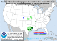
August 31, 2006 -- The center of Ernesto made its third landfall near
Long Beach North Carolina at 1130 PM EDT with maximum sustained winds
near 70 mph.
September 1, 2006 -- Ernesto becomes a tropical depression.
At 11 AM EDT the tropical storm warning from Currituck Beach Light
Southward including the Pamlico and Albemarle Sounds has been
discontinued. Gale warnings are now effect for the Atlantic coast and
the Chesapeake Bay from Surf City North Carolina northward into New
England coastal waters. See products issued by your local national
weather service forecast office. For storm information specific to your
area, including possible inland watches and warnings, please monitor
products issued by your local weather office.
At 1100 AM EDT the center of Tropical Depression Ernesto was located
near latitude 36.4 north...longitude 77.6 west or about 80 miles
west-southwest of Norfolk Virginia. The depression is moving toward the
north near 14 mph and this general motion is expected to continue
during the next 24 hours. Maximum sustained winds are near 35 mph with
higher gusts. The depression is expected to become extratropical during
the next day or two. Estimated minimum central pressure is (992 mb)
29.29 inches. Rainfall totals of 4 to 7 inches are expected over the
mid Atlantic states...including the central Appalachians, from Virginia
northward through Sunday...with isolated maximum storm totals of up to
12 inches possible. Additional 2 inch rainfall amounts are possible
over extreme northeastern North Carolina through Friday afternoon.
Life-threatening flash floods and mud slides are possible with these
rains. Isolated tornadoes are possible over extreme eastern North
Carolina and southeastern Virginia through today.
This is the last public advisory issued by the National Hurricane
Center on this system. Future information on this system can be found
in public advisories issued by the Hydrometeorological Prediction
Center, under awips header tcpat4 and wmo header wtnt35 kwnh, beginning
at 5 PM EDT
Florida
August 31, 2006 --
Situation Report No. 10 -- Tropical Depression Ernesto
Confirmed Fatalities (FDLE and ESF 16): • 1 confirmed fatality in Volusia County (auto accident)
Georgia
August
30. 2006 -- Georgia Emergency
Management Agency (GEMA) urges residents of coastal and
southeastern Georgia to prepare for possible
thunderstorms. Coastal residents should also be prepared for power
outages caused by downed trees and power lines --
NEWS
RELEASE
August
29, 2006 -- GEMA Monitors
Tropical Storm Ernesto
The Georgia Emergency Management Agency
(GEMA) is supporting local governments as it receives forecasts this
morning concerning Tropical Storm Ernesto. GEMA is closely monitoring
Tropical Storm Ernesto, along with the National Hurricane Center (NHC),
and is coordinating with local officials.
The greatest impact to Georgia could be
heavy rainfall, with predictions of up to four inches in some places.
Residents in low-lying areas should stay alert for possible flooding. A
risk of severe weather, including tornadoes spawned by Tropical Storm
Ernesto, also exists in coastal and southeastern Georgia. Area
residents should stay tuned to local radio or television for current
weather information.
Evacuation
FEMA tele-registration – 800.621.3362 (For
Individuals)
Red Cross call center - (Clothing, Food & Shelter
&
Contractors)2-1-1 or 888.317.4567
(in Texas only)
or 800 HelpNow or
800 Get-Info (nationwide)
Salvation Army – 800 SAL-ARMY (800.725.2769)
FIND LOVED ONES
American Red
Cross
877.568.3317
Find Family National Call
Center
866.326.9393
Lost Children:
Children’s Assessment
Center 713.986.3300
Google has a
name
based search engine that accesses databases of evacuees.
MCI's Registration service of evacuees.
Evacuees register
themselves
by calling 1-877-HELP-KAT (1-877-435-7528) Locate someone who
is
missing by calling 1-866-601-FIND (1-866-601-3463).
Scipionus.com
- Information
Locator Map -- Click on the map to find information posting related to
a specific area
National
Next
of Kin Registry
Salvation
Army's Team Emergency Radio Network (SATERN) ActivatedSend an
online request to locate missing family and friends. If you can't
connect to the site immediately, please try again.
Evacuation
FEMA tele-registration – 800.621.3362 (For
Individuals)
Red Cross call center - (Clothing, Food & Shelter
& Contractors)2-1-1 or 888.317.4567
(in Texas only)
or 800 HelpNow or 800 Get-Info (nationwide)
Salvation Army – 800 SAL-ARMY (800.725.2769)
FIND LOVED ONES
American Red
Cross
877.568.3317
Find Family National Call
Center
866.326.9393
Lost Children:
Children’s Assessment Center 713.986.3300
Google has a
name based
search engine that accesses databases of evacuees.
MCI's Registration service of evacuees.
Evacuees register
themselves by calling 1-877-HELP-KAT (1-877-435-7528) Locate
someone who is missing by calling 1-866-601-FIND (1-866-601-3463).
Scipionus.com
- Information Locator Map -- Click on the map to find information
posting related to a specific area
National
Next of Kin Registry
Salvation
Army's Team Emergency Radio Network (SATERN) ActivatedSend an
online request to locate missing family and friends. If you can't
connect to the site immediately, please try again.
Flooding
Georgia
Real-Time Water Data
Florida
Real-Time Water Data
South
Carolina
Real-Time Water Data
North
Carolina Real-Time Water Data
Virginia
Real-Time Water Data
Texas
Real-Time Water Data
Make
an Online
Hazard Map for Your Location
National Data
Buoy Center
NOS
WATER LEVEL
OBSERVATION NETWORK
NWS
River Forecast
Information
NWS
Flash Flood Guidance
NWS
Significant River Flood Outlook USGS
Current Water Resources Conditions
nowCOAST:
GIS Mapping
Portal to Real-Time Environmental Observations and NOAA Forecasts
National Flood
Insurance Program
National
Weather Service Precipitation Analysis
National
Weather Service
(NWS) River Forecast Centers
(return
to top of page)
Satellites
and
Radar
NOAA
GOES Satellite
Imagery for Tropical Sectors
NOAA
Multi-Dimensional Imagery from
Polar Orbiting and Geostationary Satellites
Naval
Research Laboratory (NRL) Monterey Marine Meteorology Division Tropical
Cyclone Information
NASA
MODIS Rapid
Response System
NASA (MODIS) Moderate Resolution Imaging Spectroradiometer -Gallery
NWS
National Doppler Radar
Sites
NASA
- Latest Hurricane News
NASA
- Multimedia Features
NASA
- Hurricane Resource Reel
(return
to top of page)
Track
Analysis/Best Track
National
Hurricane
Center/Tropical Predictions Center Archive of Past Hurricane Seasons
Historical
Hurricane
Tracks
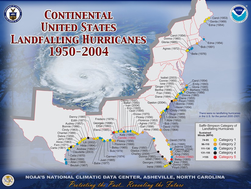
Continental
US
Landfall of Hurricanes 1950 - 2004
(return
to top of page)
Shoreline
Change
United
States Geological
Survey (USGS) Coastal and Marine Geology Program Internet Map Server
USGS
Hurricane and
Extreme Storm Impact Studies
USGS
Mapping Coastal Change Hazards
NOAA
Coastal
Services Center Topographic Data
(return
to top of page)
Environmental
Affects
NOAA
Office of Response
and Restoration
(return
to top of page)
Health
Affects
Morbidity
and Mortality Weekly Reports
For the CDC index on hurricane information (including fact sheets in
English and other languages), please see:
CDC"s
Hurricane Index
For CDC information specific to
healthcare
professionals
Hurricane-Related Documents and Resources Recently Released or Updated
Drive Safely
http://www.bt.cdc.gov/disasters/pdf/flyer-drive-safely.pdf
Returning Home After a Hurricane: Be Healthy and Safe
http://www.bt.cdc.gov/disasters/hurricanes/returnhome.asp
Cleaning and Sanitizing With Bleach after an Emergency
http://www.bt.cdc.gov/disasters/bleach.asp
Varicella Info from NIP
http://www.cdc.gov/nip/diseases/varicella/
Addition of Safe Water Tips to Announcer Read PSAs
http://www.bt.cdc.gov/disasters/hurricanes/psa_announcerreads.asp#rita
Disposal of Contaminated Medical Devices – FDA site
http://www.fda.gov/cdrh/emergency/disposal.html
Contact Information for Questions about Clinical Investigations
Affected by Hurricane Katrina – FDA site
http://www.fda.gov/cder/emergency/clin_invest.htm
Carbon Monoxide Poisoning After Hurricane Katrina --- Alabama,
Louisiana, and Mississippi, August--September 2005 – MMWR
Article
http://www.cdc.gov/mmwr/preview/mmwrhtml/mm54e930a1.htm
The following documents have been recently UPDATED:
Effects of Hurricane Katrina on Children's Blood Lead Levels
http://www.bt.cdc.gov/disasters/hurricanes/katrina/leadkatrina.asp
Translations for the following documents are now available:
(return
to top of page)
Damage
Assessment and
Post-Storm Impact Data
OCHA Situation Report No. 2
Caribbean: Hurricane Ernesto
1 September
2006
Source: UN Office for the Coordination of Humanitarian
Affairs
This situation report is based on information provided by the office
of the UN Resident Coordinators in Cuba and Haiti, the IFRC and media
reports.
Situation
1. Tropical storm Ernesto passed over Haiti and
Cuba on 28 and 29 August, bringing more than 15 cm of rain. Ernesto left Cuba
near Key Romano in the northern part of Ciego de Avila province causing heavy
rains in the Eastern portion of the island especially in Maisi in the most
Eastern province and Guantánamo. On 29 August, Ernesto continued towards Florida
bringing heavy rains to Ragged Island, Great Exuma in the Central Bahamas,
Andros Island, the Berry Islands, the Biminis and Grand Bahama Island in the
Northwestern Bahamas and Florida Keys.
2. According to the US National
Hurricane Center, Ernesto is moving inland over Eastern North Carolina, still
producing winds of tropical storm force and heavy rains. A tropical storm
warning remains in effect from North of the South Santee River to Currituck
Beach light including the Pamlico and Albemarle Sounds. Gale warnings are in
effect for the Atlantic coast and the Chesapeake Bay North of the tropical storm
warning area due to a strong pressure gradient North of Ernesto. A hurricane
watch remains in effect from South Santee River South Carolina to Cape Lookout
North Carolina.
Impact & Needs
HAITI
3. According to official
figures as of 30 August, 4 people died, 5 resulted injured, 492 people had to
evacuate to relative's houses, 520 houses were damaged and 93 houses and 1
school were destroyed. Several localities (Martissant, Gressier and Mariani)
along southbound roads were flooded. No major damage is reported and floodwaters
have now subsided.
CUBA
4. All central and Eastern Cuban provinces are
now in recovery phase, and the evacuated people returned to their homes under
the coordination of the National Cuban Defense authorities. Dams in the
southern provinces of Cuba that were suffering from drought are now full. No
casualties or serious damage were reported.
National
response
HAITI
5. The National Risk and Disaster Management Committee is
providing relief assistance in conjunction with the International Community
Supporting Group (ICSG).
UN & International response
HAITI
6.
MINUSTAH continues supporting logistics and needs assessments in all
Departments.
CUBA
7. The UN System continues the coordination and
information links and exchanges with the Central Command of Civil Defense and
the Ministry for Foreign Investment and Economic Collaboration (MINVEC) and the
International Community.
8. OCHA remains in close contact with UN
Resident Coordinator in Cuba and UN Humanitarian Coordinator in
Haiti.
This situation report, together with additional information on
other ongoing
emergencies, is also available on
http://www.reliefweb.int
OCHA Situation Report No. 1
Caribbean: Hurricane Ernesto
29 August 2006
Source: UN Office for the Coordination of Humanitarian Affairs
This situation report is based on information provided by the office of
the UN Resident Coordinators in Cuba and Haiti.
Situation
1. On 27 August, Ernesto briefly became this year's first Atlantic
hurricane, but was downgraded to tropical storm status as it reached
southern Haiti one day later. In Haiti heavy rains hit the coastal
areas of the departments of Grand-Anse, L'Artibonite, and the Northwest
of the country.
2. After leaving Haiti, Cuba´s Eastern zone was the first
touched by the eye of Tropical Storm Ernesto, which although weakened,
struck the Cuban territory on 28 August, near Playa Cazonal, located in
the border of the eastern provinces of Santiago de Cuba and
Guantánamo. Ernesto is forecast to re-strengthen
when the center moves over the waters to the north of Cuba towards
Florida, later today.
3. According to the US National Hurricane Center a tropical storm
warning and a hurricane watch are now in effect from New Smyrna Beach
southward on the East coast including lake Okeechobee, from Bonita
Beach southward on the West coast and for all of the Florida Keys from
Ocean Reef to the Dry Tortugas, for Ragged Island and Great Exuma in
the Central Bahamas, as well as, for Andros Island, the Berry Islands,
the Biminis and Grand Bahama Island in the Northwestern Bahamas. A
Hurricane warning may be required for portions of South Florida and the
Florida Keys later this morning. A tropical storm watch remains in
effect from North of Bonita Beach northward to Englewood on the Florida
West coast.
4. Ernesto is moving toward the northwest near 14 mph (22
km/hr) and this general motion is expected to continue for the next 24
hours. On the forecast track the center of Ernesto will be near the
Florida Keys or Southeast Florida by this evening. However brief
periods of violent wind or rain will be moving onshore these areas
during the afternoon.
5. The Government of Cuba has discontinued all tropical storm warnings
for Cuba.
Impact & Needs
HAITI
6. According to official figures, 2 people died, 3 resulted injured,
200 people had to evacuate to relative's houses, 134 houses were
damaged and 19 houses and 1 school were destroyed.
CUBA
7. Damage and needs assessment is still on-going.
National response
HAITI
8. The Risk and Disaster Management Committees participated in joint
assessment missions in each affected Department with MINUSTAH and
humanitarian partners. By 28 August (6:00 p.m. ? Local time) the
tropical storm and flooding warning was discontinued.
CUBA
9. The Government adopted the following preventive actions:
- More than 200,000 persons were evacuated in the central and
eastern provinces.
- Preventive measures were taken in the agricultural sector to
protect the crops and tobacco production
- Animals were relocated to safe areas
- The Government made available emergency electrical generators
- Shelters were activated as well as food production centers
- A permanent monitoring of the water levels was put in place
- Communication facilities were arranged
UN & International response
HAITI
10. MINUSTAH continues supporting logistics and assessments in all
Departments and the International Community Supporting Group (ICSG) has
been collecting and sharing information on damages and casualties.
CUBA
11. The UN System continues the coordination and information links and
exchanges with the Central Command of Civil Defense and the Ministry
for Foreign Investment and Economic Collaboration (MINVEC) and the
International Community.
12. OCHA remains in close contact with UN Resident Coordinator in Cuba
and UN Humanitarian Coordinator in Haiti.
13. This situation report, together with additional information on
other ongoing emergencies, is also available on
http://www.reliefweb.int.
(return
to top of page)
Other
sites
The Hurricane Watch Net
HurricaneTrack.com
Caribbean
Hurricane Network
Hurricane
Strike!
Hurricane Science & Safety For Students
DURING
A HURRICANE WATCH
(A Hurricane Watch is issued when there is a threat of hurricane
conditions within 24-36 hours.)
1. Listen to a battery-operated radio or television for hurricane
progress reports.
2. Check emergency supply kit.
3. Fuel car.
4. Bring in outdoor objects such as lawn furniture, toys, and garden
tools and anchor objects that cannot be brought inside.
5. Secure buildings by closing and boarding up windows. Remove outside
antennas.
6. Turn refrigerator and freezer to coldest settings. Open only when
absolutely necessary and close quickly.
7. Store drinking water in clean bathtubs, jugs, bottles, and cooking
utensils.
8. Store valuables and personal papers in a waterproof container on the
highest level of your home. 9. Review evacuation plan.
10. Moor boat securely or move it to a designated safe place. Use rope
or chain to secure boat to trailer. Use tiedowns to anchor trailer to
the ground or house.
Source: floridadisaster.org/
Florida's Division of Emergency
Management
(return
to top of page)


